


Image
AN_ENTREE-GEOLOGIE.jpg
Geology and knowledge of the subsurface
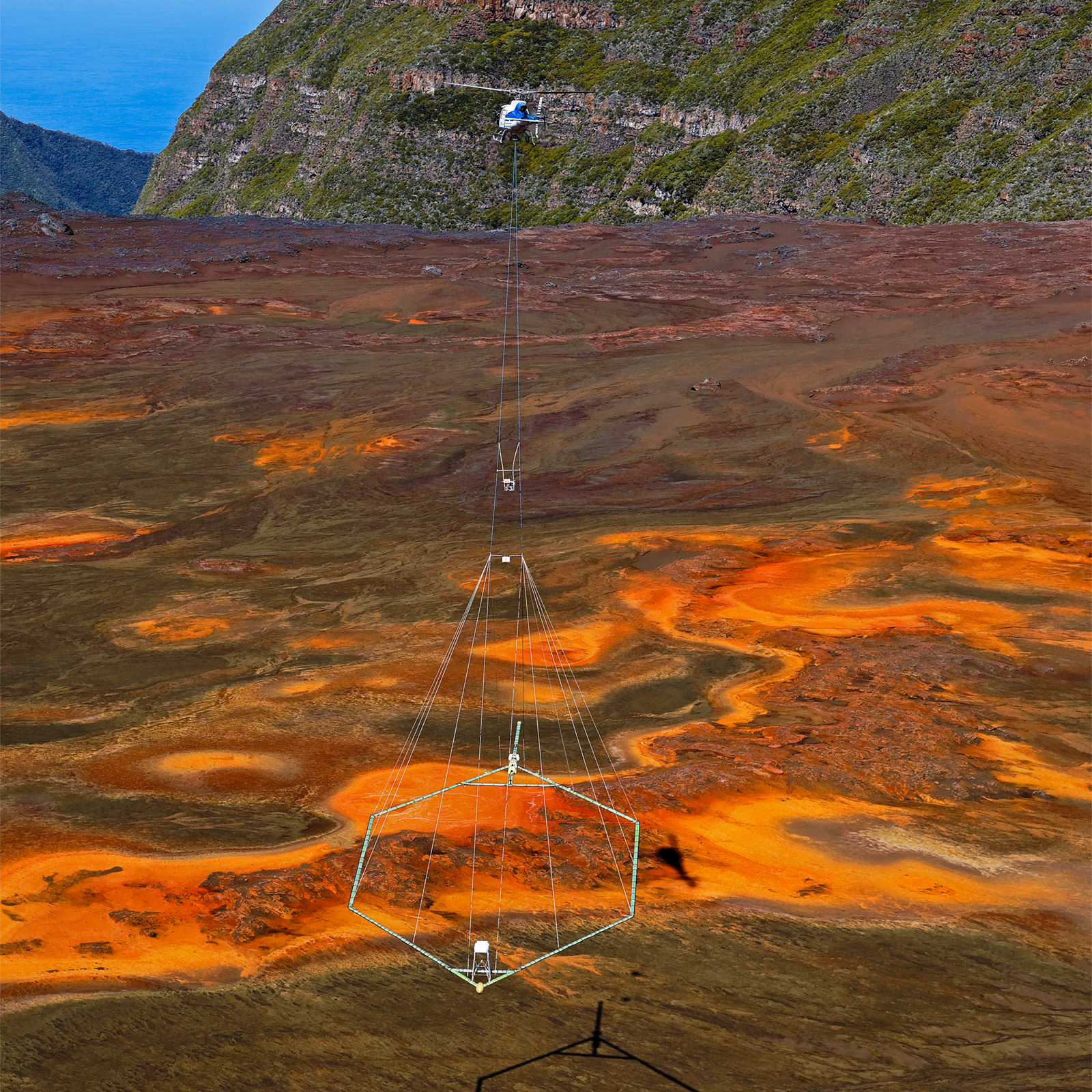
Heliborne geophysical survey of Reunion Island. The campaign and the data obtained provide images of the first 200 metres of the subsurface. © BRGM - René Carayol
The challenge today is to refine this knowledge in depth, in order to improve mapping of the subsurface and gain a clearer understanding of geological phenomena. BRGM aims to provide information that is increasingly detailed and accurate, as well as being immediately exploitable in order to develop more diversified and sustainable uses of the subsurface and its resources.
of airborne geophysical surveys in the Massif Central in 2022.

