


Image
Légende
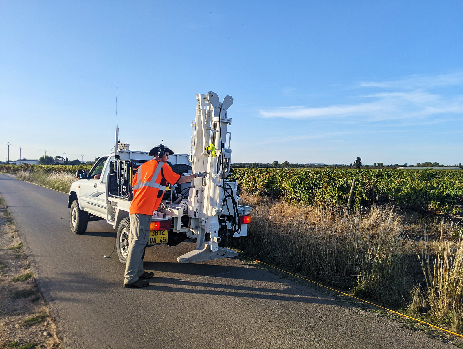
New high-resolution seismic reflection data have been acquired in the commune of Mauguio in the Hérault department. © BRGM
Groundwater and resource preservation
Following a previous feasibility study, the Pays de l’Or agglomeration asked BRGM to assess the hydrogeological potential of the capped Jurassic limestone formations underlying its territory, to enable it to diversify its drinking water supply. The first two phases were delivered in 2024. The approach combined an inventory of the boreholes reaching down to the Jurassic limestone formations, geophysical mapping and 2D imaging using high-resolution seismic reflection and electrical resistivity tomography. By analysing the data, we identified the structural layout, the nature of both the surface and deep formations and the discontinuities that affect them. BRGM has recommended further investigations to develop a geological and hydrogeological model of this aquifer.
New high-resolution seismic reflection data have been acquired in the commune of Mauguio in the Hérault department. © BRGM
Focusing on the interdependence between water, energy, food and ecosystems (the “WEFE nexus”) in the face of global climate change and the increasing demands for water, the GoNEXUS project (Horizon 2020), which includes BRGM and the University of Dakar, investigated the Senegal River. The methodology combined participatory workshops with various stakeholders (water managers, administrative bodies, agricultural sectors, local elected representatives, NGOs, etc.) and a hydro-economic model. This work identified the challenges facing the WEFE nexus, explored several scenarios for its development and included discussions on solutions for the sustainable management of the river.
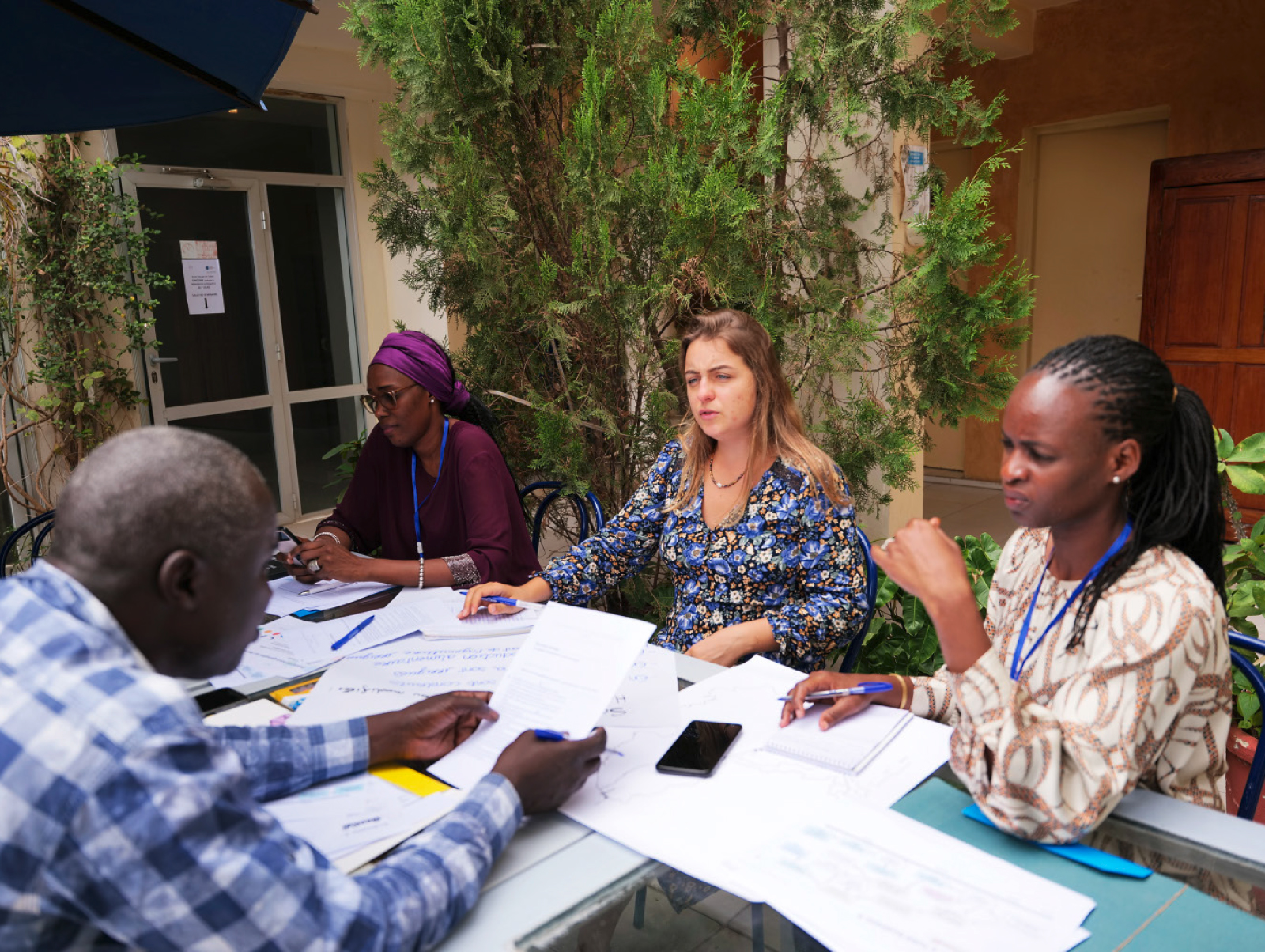
Exploring different water management and development scenarios for the Senegal River with local stakeholders. © BRGM
Georges Farina received an award from BRGM for his CIFRE thesis entitled “Economic Valuation of Innovative Rainwater Management Solutions”. His work resulted in a decision-making support tool for complex spatial trade-offs in the planning of nature-based solutions (NBS) for recharging shallow aquifers in the Bordeaux metropolitan area. This tool is transferable to other localities. The work required a cross-disciplinary approach, including a hydrogeological assessment of the recharge capacity and an economic assessment of the public demand for the ancillary benefits of nature-based solutions (combating urban heat islands) and land costs. The thesis appeared in scientific articles in three international publications.
BRGM has increased its capacity to identify and characterise water resources by acquiring a Picarro L2140i spectrometer with Cavity Ring-Down Spectroscopy (CRDS). This instrument is used to accurately monitor changes in the isotopic signature of water in the laboratory and in the field using a Continuous Water Sampler (CWS) module that samples and analyses the water every second directly from a source. This equipment can be used to monitor water quality and aquifer behaviour.
Thermal anomalies in rivers are mainly caused by groundwater inflows and provide refuges for aquatic biodiversity. The ESTHER project is studying the interactions between aquifers and rivers on the basis of three sites in the Rhône-Mediterranean-Corsica basin in different hydrological and hydrogeological contexts: the Argens (Var), the Drac (Hautes-Alpes) and the Veyle (Ain). This work, which has already highlighted the role of groundwater in regulating the temperature of surface water, is now focusing on characterising its thermal impact according to the conditions in which it emerges and the development and management of the river. It is expected that the results will enable the development of a model to simulate the impact of climate change on these thermal refuges.
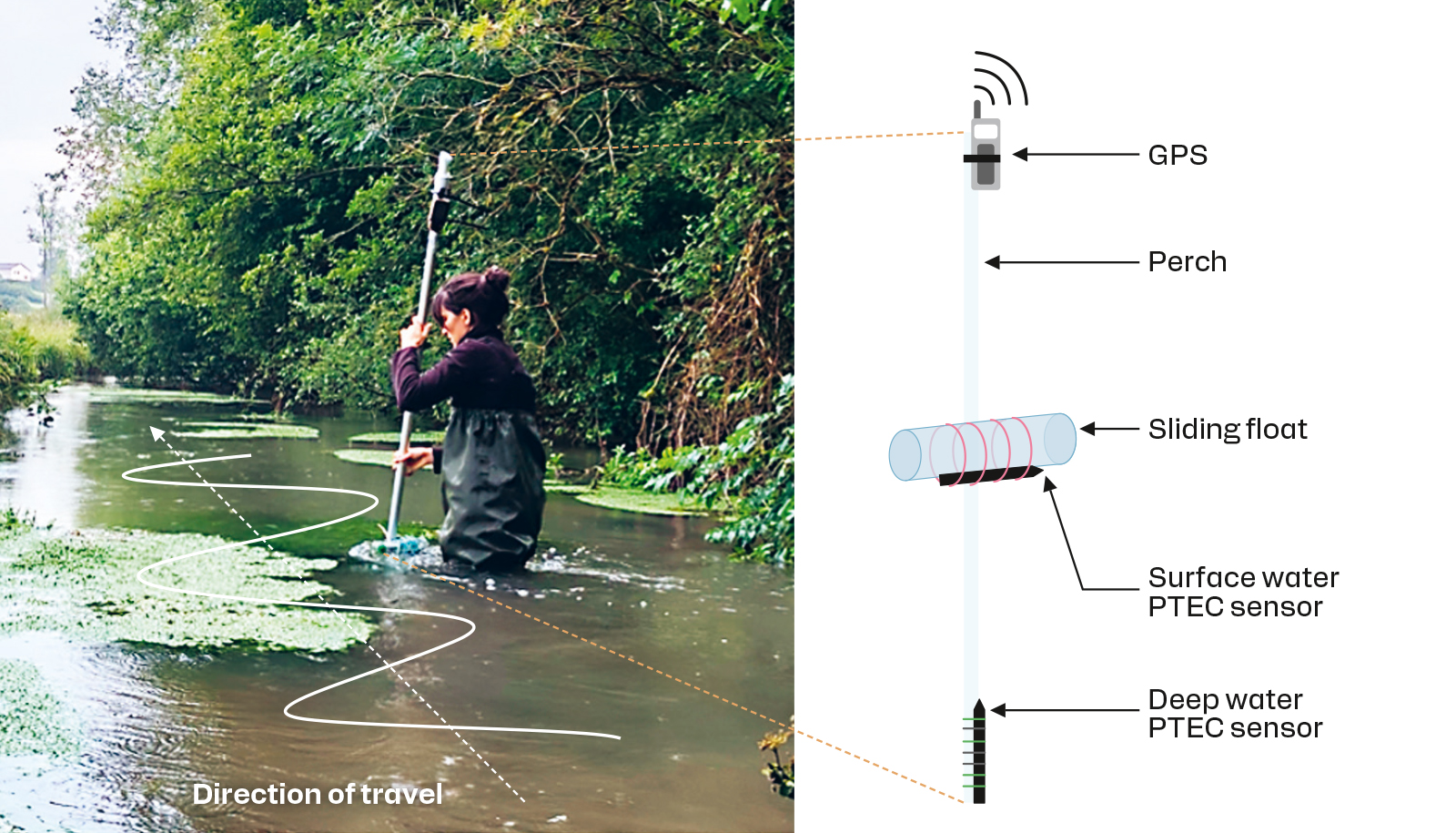
Double temperature measurements, at the surface and at depth, along the Argens river (Provence Verte) reveal the thermal anomalies caused by the inflow of groundwater at the bottom of the watercourse. © BRGM
In 2024, the school scientific mediation initiative on groundwater was repeated with pupils from elementary to high school, together with their teachers. Designed and led by a BRGM hydrogeology researcher, the one-hour classroom sessions are based around experiments using hydrogeological models to illustrate the subsurface, the water cycle, the dynamics of the water table and the impact of human activities. This approach, involving questioning, handling, observing and interpreting, also introduces students to the scientific process and promotes the profession of researcher and the role of women in science.
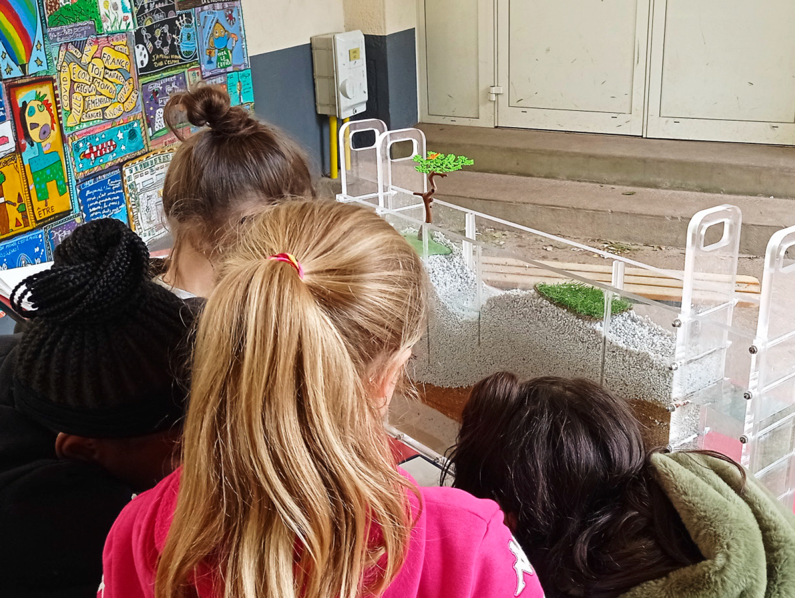
Hydrogeological models help students to better understand groundwater issues through hands-on observation, as seen here at the Jules Lenormand school in Saint-Jean-de-la-Ruelle in the Loiret department. © BRGM - G. Picot-Colbeaux
In confirmation of the value of MétéEAU Nappes (a tool for real-time monitoring and forecasting of groundwater levels in France), BRGM has developed a similar site for the city of Cape Town in South Africa with the support of the French Development Agency. This collaboration also included training in the use of this local MétéEAU Nappes and the characterisation of emerging contaminants in rainwater that are likely to adversely affect groundwater quality.

