Légende
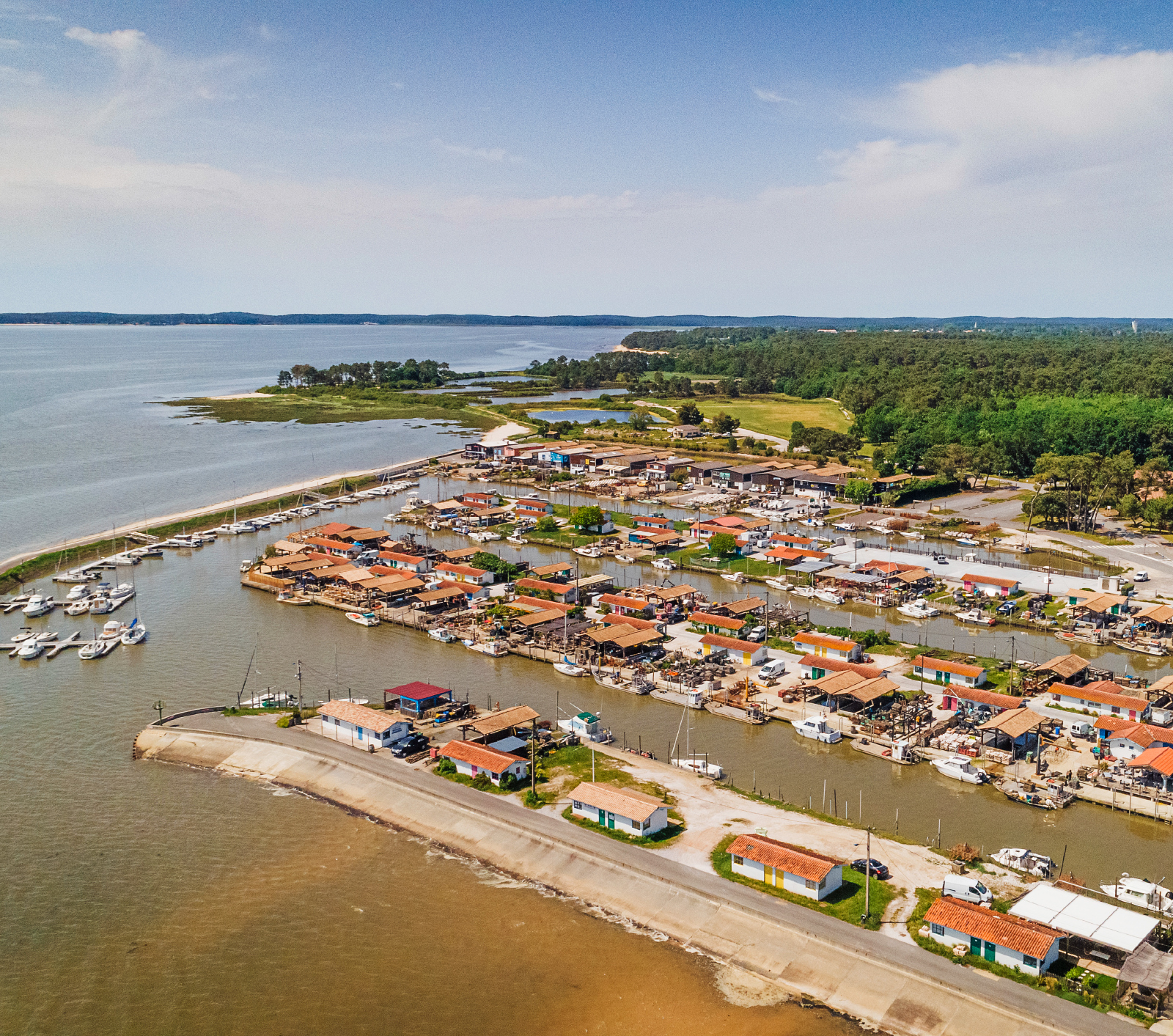
The subsidence study covered 41,000 coastal flood plains in Europe, particularly those with critical infrastructure and activities, such as the port of Arès in the Arcachon basin in the Gironde department of south-west France. © Observatoire de la côte de Nouvelle-Aquitaine, Agence Odds
We already know that global warming is causing sea levels to rise. Satellite measurements over the past thirty years put the overall figure at 3.6 millimetres per year. And that is not all: the ground may subside locally, amplifying the relative rise in the sea level. “In Europe, half of low-lying coastal areas are impacted by what we call subsidence,” explains Rémi Thiéblemont, who has studied this phenomenon at the European level. Something that was impossible until recently.
EGMS data from Copernicus
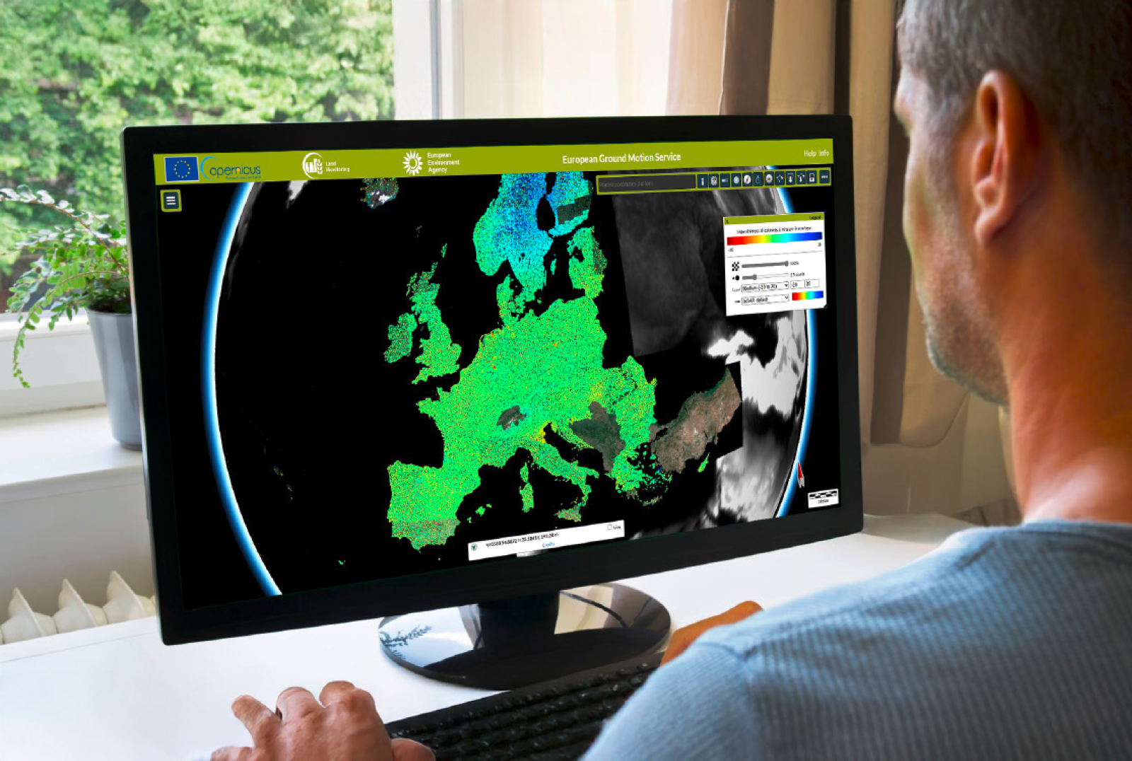
“Mapping vertical ground movements on a supra-regional scale has long been hampered by a lack of appropriate data and services,” he continues. Developed by a consortium of researchers as part of Copernicus – the EU Earth observation programme – the European Ground Motion Service (EGMS) combines two methods – radar interferometry (InSAR) and the Global Navigation Satellite System (GNSS) – to address this aim. It provides high-quality, high-resolution characterisation of ground movements in Europe, with millimetre precision! “BRGM was the first organisation to use EGMS data on this scale,” points out Rémi Thiéblemont, who looked only at coastal data for the purposes of this study. A total of 41,000 “coastal flood plains” were taken into account, including sectors considered to be of key importance, owing to the presence of urban centres or critical infrastructures such as ports and airports.
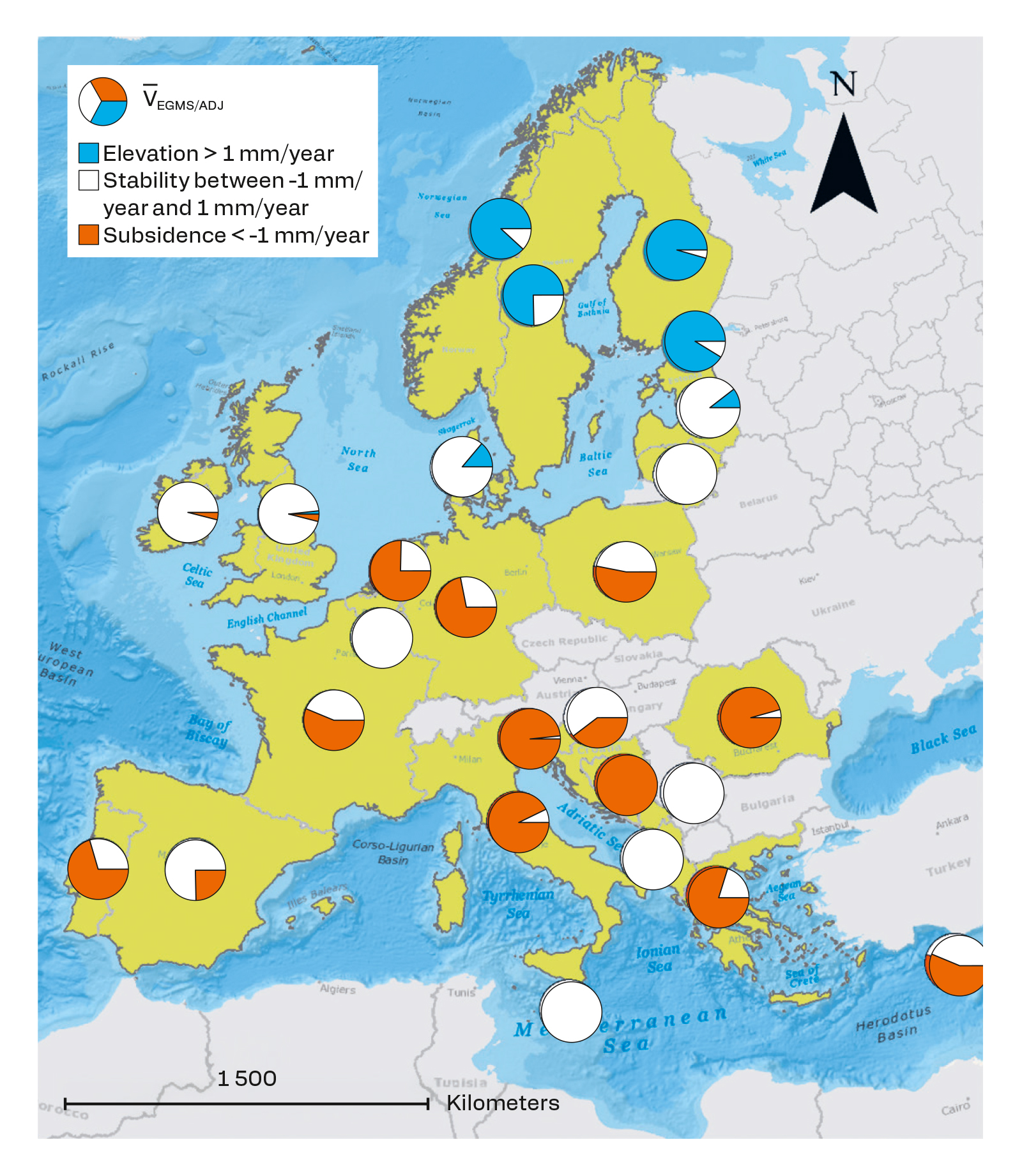
These data were statistically processed to provide a spatialised overview of vertical ground movements (elevation, stability, subsidence) along European coastlines. The results encourage closer study of this phenomenon, which varies from country to country. Among the worst affected are Italy, the Netherlands and France, where over 50% of low-lying coastal areas are experiencing subsidence averaging more than 1 millimetre per year. The phenomenon is particularly significant in areas with a dense population or heavy infrastructure, where the figure may exceed 5 millimetres per year!
Légende
The red, white and blue diagrams indicate the proportion of the CFP zone in each country and whether, on average, it is rising (> 1 mm/year), stable (between -1 mm/year and 1 mm/year) or subsiding (< -1 mm/year). © BRGM
Pooling skills and approaches
The work is co-funded as part of two European projects: CoCliCo, on rising sea levels and measures of adaptation, and GSEU, which focuses more specifically on coastal vulnerability and climate change. “This work provides a strong, accurate and homogeneous basis for the study of coastal subsidence in Europe, since it applies a single method for quantifying the phenomenon on this scale,” explains Aurélie Maspataud. While these results can be used to correct existing models for projecting sea levels and calculating the risks associated with coastal flooding, they cannot be used for extrapolation into the distant future. “They’re based on recent observations over a short period (2016-2021), so they’re more like a snapshot of coastal subsidence,” continues Aurélie Maspataud. “But to make projections, we need to understand the causes behind the phenomenon and how they evolved over time.” These questions led to a proposal for a thesis in the region of Nouvelle-Aquitaine, supervised by BRGM, which seeks to shed light on the underlying mechanisms of vertical ground movements by cross-referencing EGMS data with geological and hydrogeological data.
At the same time, this first map of coastal subsidence in Europe has already attracted the interest of the scientific community. An article published in the journal Earth’s Future in summer 2024 highlighted the need to pool skills and approaches in order to address this issue. The aim is for scientists specialising in the impact of climate change on sea levels to work with geologists studying coastal subsidence, both at the European level. For Rémi Thiéblemont and Aurélie Maspataud, the key objective is to “develop our knowledge of this phenomenon in order to better assess the associated risks and inform coastal management strategies in Europe”.
Légende
BRGM was the first organisation to use the EGMS service of Copernicus, the EU Earth observation programme, on this scale. © BRGM