Image
Légende
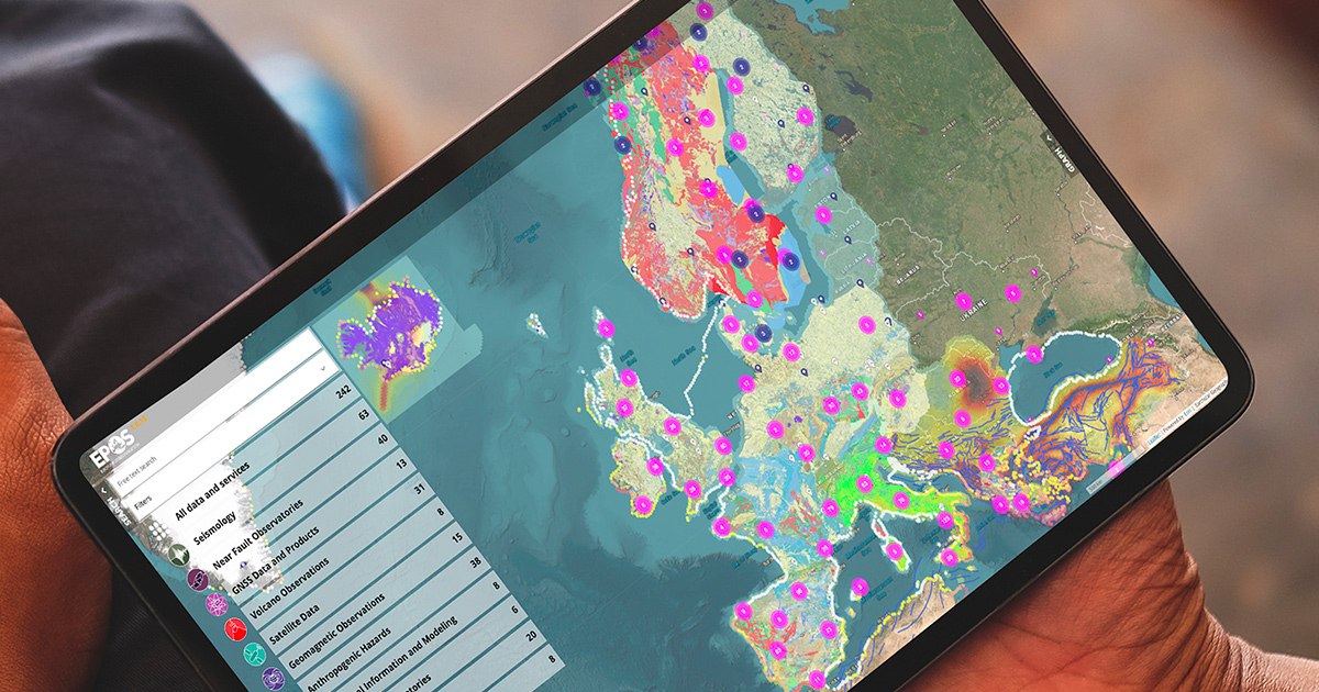
Thematic data services on the EPOS map portal. The pink circles are groups of geodetic measurement stations. The grey circles show groups of magnetotelluric measurement stations. © EPOS ERIC
Digital data, services and infrastructure
After more than 20 years of research and innovation, the EPOS (European Plate Observing System) data portal, the research infrastructure for solid Earth science, has been officially presented to the scientific community (EGU23, European Geosciences Union).
To encourage multi-disciplinary research, the portal offers open and integrated access to more than 260 data sets and online services covering around ten themes (seismology, geomagnetism, geodesy, tsunamis, etc.). As part of the "Geological Information and Modelling" consortium which it coordinates, BRGM provides French geological map data at a scale of 1:1,000,000, borehole data and geological models.
www.epos-eu.org
www.ics-c.epos-eu.org
Thematic data services on the EPOS map portal. The pink circles are groups of geodetic measurement stations. The grey circles show groups of magnetotelluric measurement stations. © EPOS ERIC
The aim of the computerised management application for frequent automatic-monitoring data (GIDAF), offered to operators of facilities that are vulnerable to pollution, is to collect the results of analyses (water, air, noise) to check compliance with the requirements of facilities that are classified for environmental protection (ICPE), or for Water Agencies responsible for collecting water pollution charges. BRGM and the General Directorate for Risk Prevention (DGPR) have given it a major technical and ergonomic overhaul, with the emphasis on massive user consultation via a survey of their satisfaction and requirements.
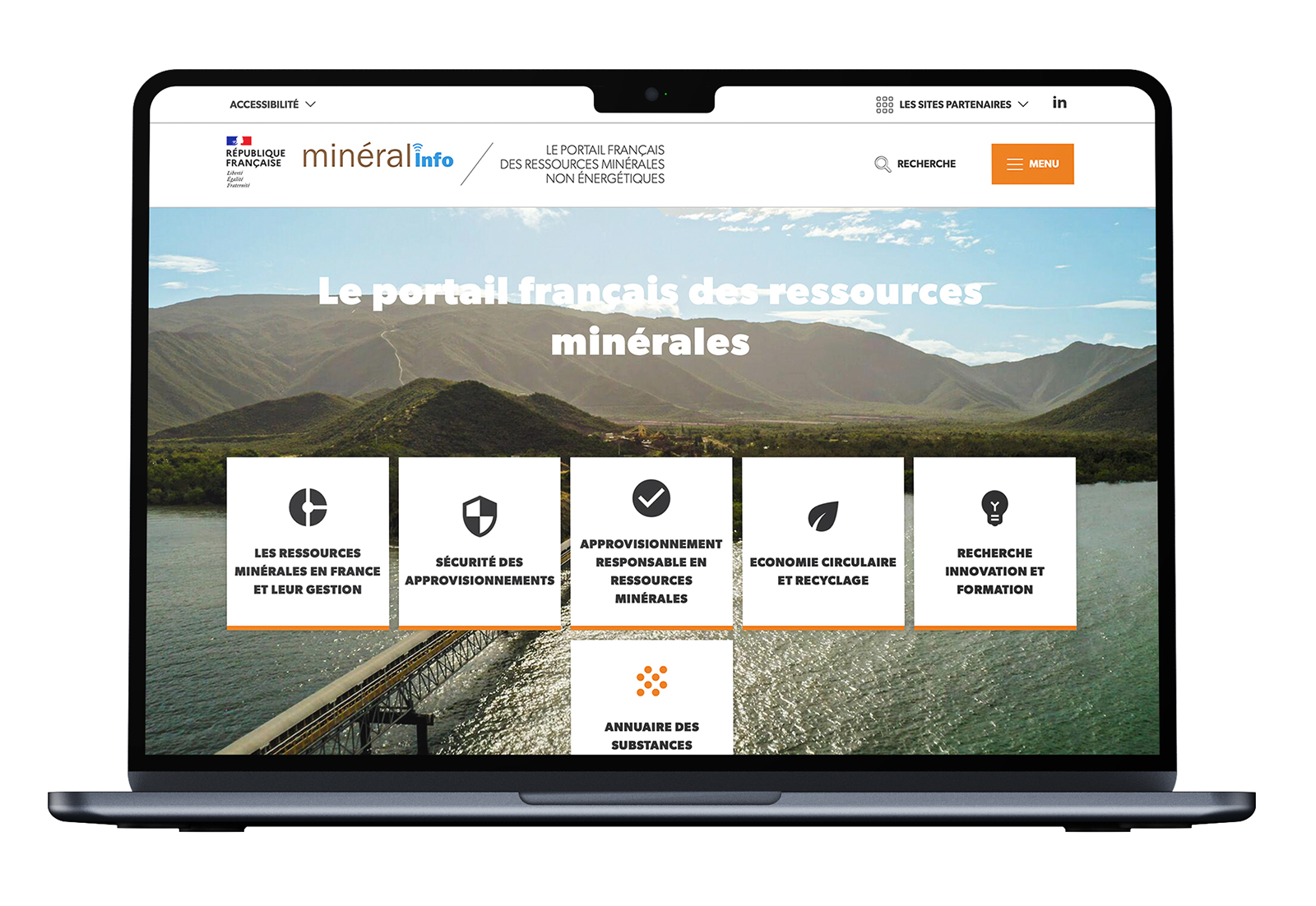
As part of the energy transition and the drive to reduce our dependence on fossil fuels, the Mineralinfo mineral resources portal offers a list of critical substances.
The UX/UI user-centred approach has led to a better understanding of the information by the general public: use and consumption, global production, resources and reserves, etc., parameters that have become more accessible and intelligible, making it possible to understand how each substance ranks in a criticality matrix.
www.mineralinfo.fr
A decision has been made to combine the two digital services that are currently used to track waste, excavated earth and sediments, namely: Trackdéchets – used for tracking hazardous waste – and the French national register for waste, excavated earth and sediments (RNDTS - Registre national des déchets, terres excavées et sédiments), which is used for declaring movements of waste, excavated earth and sediments. The aim is to simplify the procedures for checks by government departments and for users. BRGM is responsible for combining the two applications and guaranteeing their long-term robustness and viability. This will involve harmonising the design and creating a single authentication for logins and unique user profiles.
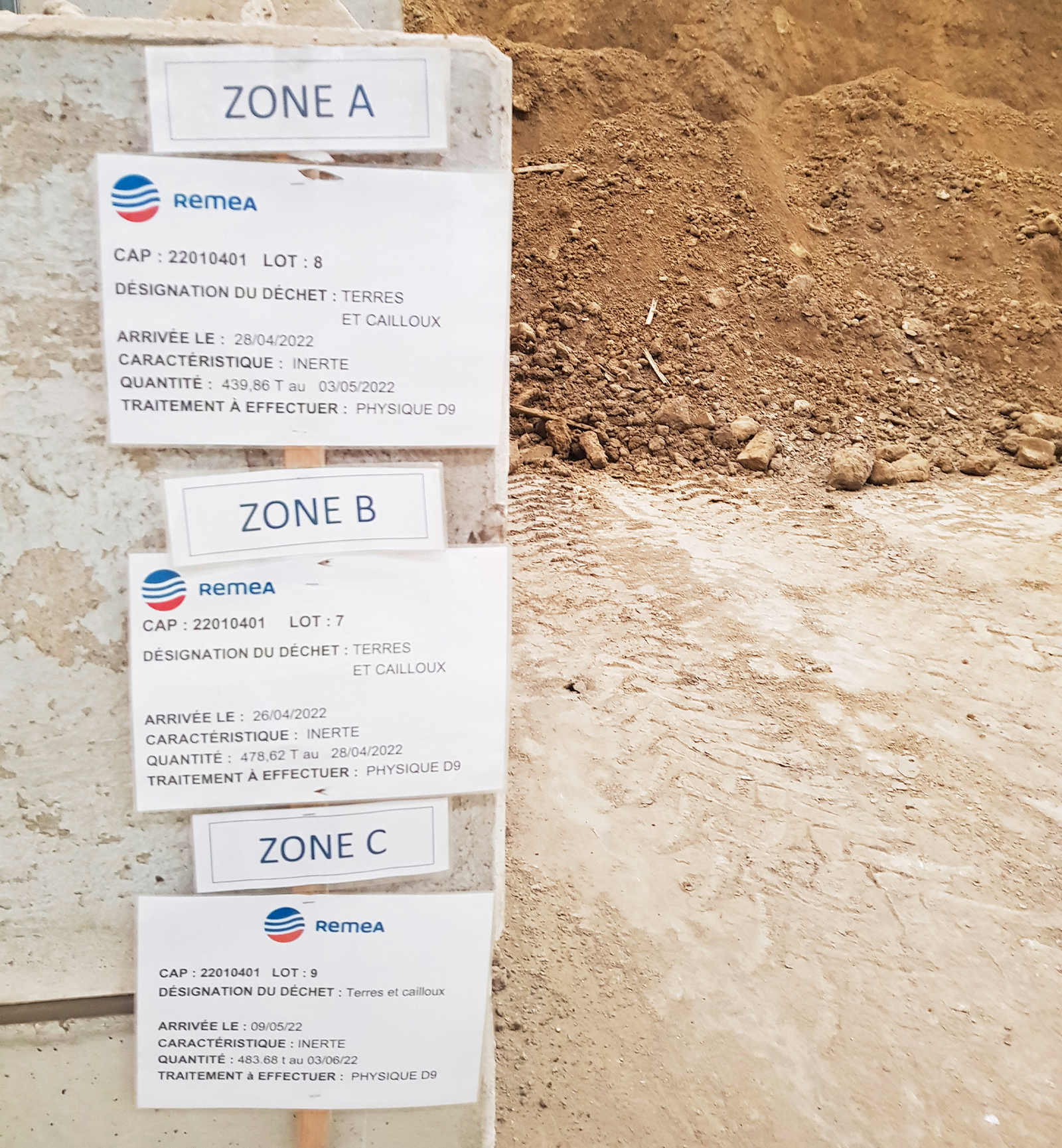
Classification of soil batches on a processing platform. © BRGM – N. Dubrac
Bringing together ten projects, the JUNON programme aims to develop a digital research cluster devoted to the subject of the continental environment in the Centre-Val de Loire region. The development of the first digital twins has begun, and BRGM has made significant progress on the twins for WATER, notably with the characterisation of three sectors, each with a type of distinct behaviour, in the Beauce region.
At the same time, user consultations and comparative studies on data management technologies have been carried out in order to better plan the architecture of future JUNON platforms.
![Subsurface in the Orléans region: Location of buried pipe networks and 3D visualisation of cavities beneath the former Porte Madeleine hospital. © Esri [Live] SIG 2023](/sites/default/files/2024-07/AN_EN-BREF_JUNON.jpg)
Subsurface in the Orléans region: Location of buried pipe networks and 3D visualisation of cavities beneath the former Porte Madeleine hospital. © Esri [Live] SIG 2023
As a member of the Open Geospatial Consortium (OGC), BRGM is working on the interoperability of geoscience and environmental data. Having already contributed to several standards (geology, hydrogeology, surface hydrology, API for exchanging observations), BRGM co-managed the review of the "Observations, measurements & samples" standard in 2023, in order to facilitate dialogue between scientific and technical communities. This could form the basis of many information systems used for observations or samples.