


Image
Légende
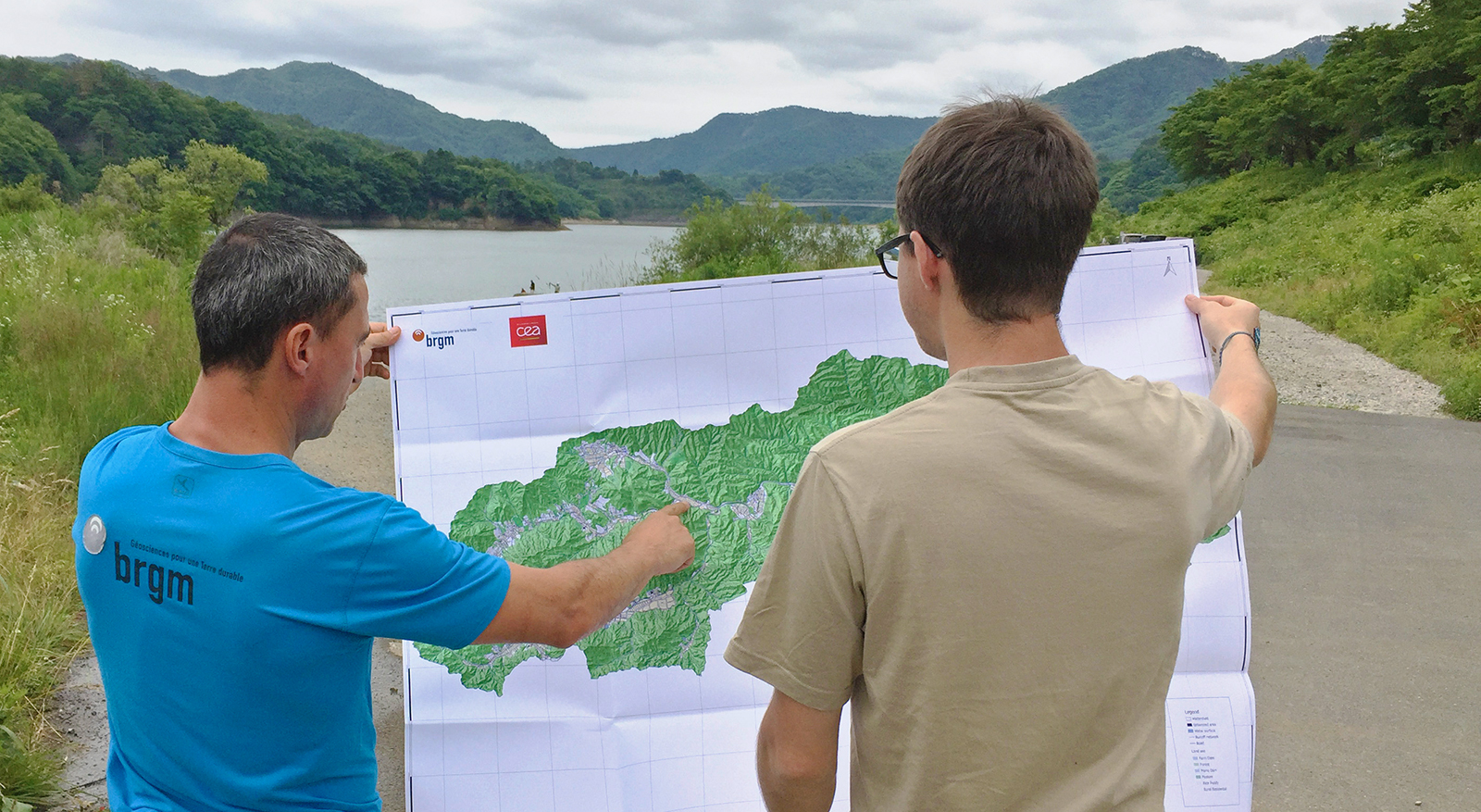
Field survey to locate soil and sediment samples in a catchment area subjected to radioactive fallout in the Fukushima prefecture. © BRGM – O. Evrard
Risks and spatial planning
In 2022, BRGM and Cerema drew up methodological recommendations under the auspices of the French Ministry for Ecological Transition and Territorial Cohesion for mapping areas at risk of coastline retreat in the medium (30 years) and long term (100 years), for use by municipalities implementing the new regulatory tools set out in the 2021 Climate and Resilience Act.
Following the signing of an agreement with the Ministry in 2023, BRGM is now working with Cerema to set up a national programme to support decentralised government departments and local authorities in launching and monitoring the studies needed to produce these local maps. This will involve drawing up a set of specifications, providing technical support, organising regional and national information sessions and bringing a community of stakeholders into a network.
Coordinated by the Institute for Radiological Protection and Nuclear Safety (IRSN), the aim of the Amorad project was to optimise models for predicting the dispersion of radionuclides in the environment and assessing their impact on the marine environment and terrestrial ecosystems. Initially launched in 2013, this research programme was extended in 2019 to cover an assessment of the environmental impact of a nuclear accident. BRGM was tasked with proposing a method for quantifying the export of radionuclides from catchment areas to the sea.
The developed model was calibrated near Fukushima and then integrated into a series of tools developed by IRSN and BRGM. It was used to produce the first model of the dynamics of caesium 137 (137Cs) transfer from surface deposits to the sea and to assess the direct costs of contamination of an area following a serious nuclear reactor accident.
Field survey to locate soil and sediment samples in a catchment area subjected to radioactive fallout in the Fukushima prefecture. © BRGM – O. Evrard
In partnership with IPREM (University of Pau and the Pays de l'Adour), ISTERRE (IRD), SAS-GAIA and BRGM, Naomi Nitschke's CIFRE thesis examines what happens to mercury and lead in relation to the remediation of gold mining sites and the rehabilitation of soils in French Guiana.
Several surveys to measure the temporal flows of these elements during periods of high rainfall were carried out at the Awa site in Grand Santi in western French Guiana, taking samples of water, suspended matter and soil. The project will be extended in 2024 through collaboration with the Directorate-General for Land and Sea (DGTM) and the French Guiana regional authority.
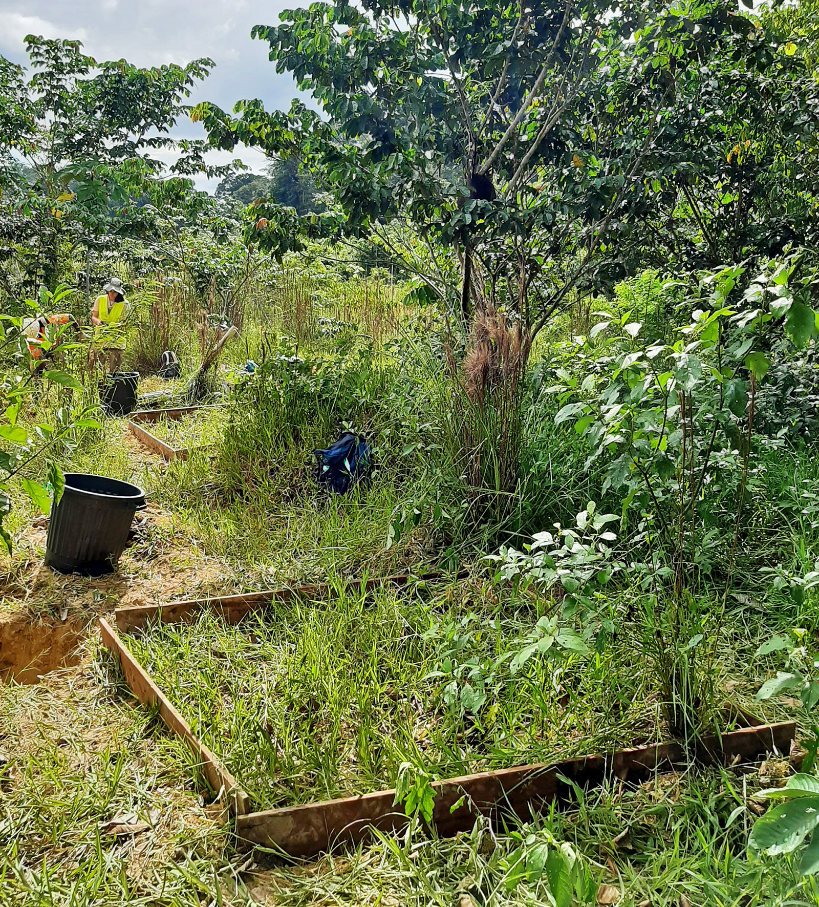
Plots for measuring surface flows in an area rehabilitated two years ago (Awa site, Grand Santi). © BRGM
The aim of the PFAStwin project is to build the capacity of the Faculty of Chemistry at the University of Belgrade (UBFC) in the analysis and (bio)remediation of areas contaminated with Perfluoroalkyl and Polyfluoroalkyl Substances (PFASs) and to manage Horizon Europe projects through collaboration with institutes in partner countries: France and Spain. Professor Vladimir Beskoski was welcomed to BRGM as a guest researcher in October 2023 to visit our premises and experimental facilities and to exchange views with our researchers. A workshop was held on the topic of PFASs, with presentations of work carried out on the subject at BRGM, UBFC and the Swedish Geotechnical Institute (SGI).
BRGM is coordinating the ANR SargAs&CLD project (2020-2023) with six partners, on the environmental risks associated with sargassum (brown seaweed) in the French West Indies. Sargassum, which washes up on beaches and is then stored inland, contains arsenic and chlordecone. It releases leachate with arsenic levels of up to 10 mg/L, produces arsine gas, and also contains potentially pathogenic microbial genera. This situation is of great concern to the local authorities and local populations. The sociological aspect of the project shows that 38% to 52% of those questioned trust the State to manage the crisis and only 5% to 10% trust scientists!
BRGM's work shows that these substances in sargassum leachate can be eliminated using natural geomaterials from Martinique and French Guiana, and activated carbon doped with iron. BRGM is working with local authorities to design leachate treatment units and to study the environmental risk posed by sargassum on beaches and its storage in the ground.
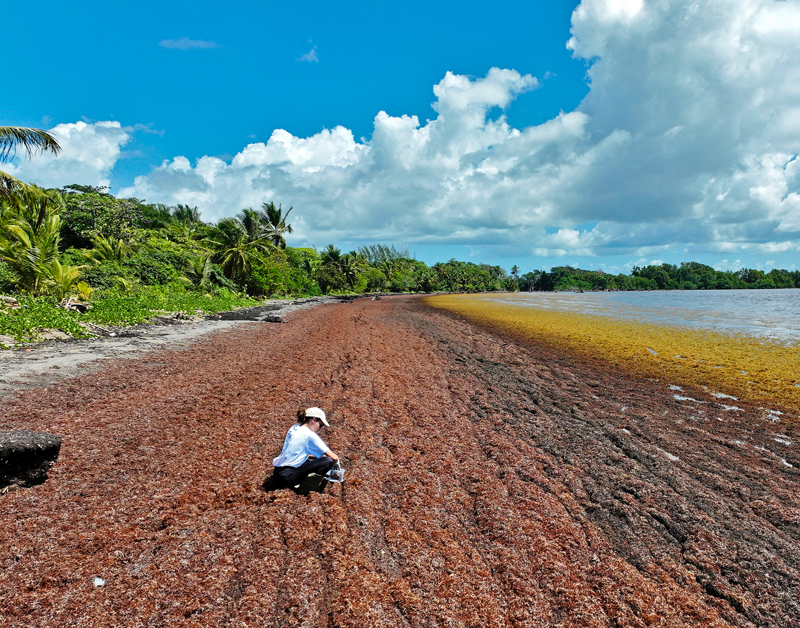
Agent collecting sargassum on Viard beach (Petit-Bourg, Guadeloupe, 2023). © BRGM – S. Chapron
Mayotte's lagoon is under threat from terrigenous inputs, not only from the "padzas" (badlands) but also, and above all, from weeded agricultural plots (cassava, bananas) and the many construction sites aimed at coping with potential demographic pressure (+45% of inhabitants in 10 years). As part of the Leselam project undertaken in 2015 (to combat soil erosion and siltation of the lagoon in Mayotte), an observatory has been set up in three catchment areas to continuously monitor run-off and erosion. By integrating the data collected into the Watersed sediment transfer model, BRGM was able to produce the first quantitative map of the island's erosion, in 2018 and then 2022: in four years, the amount of soil ending up in the lagoon has increased by 17% (almost 25,000 tonnes in 2022)!
The Leselam project also involves disseminating best practice among farmers, raising awareness among the local population, including children (presentations in schools) and various communication campaigns (films, cartoons, plays, etc.).
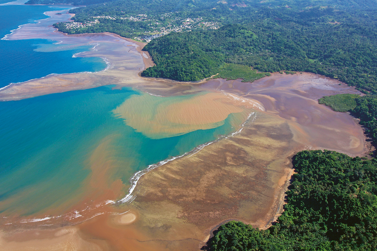
Panache turbide dans le lagon de Mayotte. © BRGM
In the Lorraine coalfield, GRDF has measured methane in the Petite-Rosselle municipality (57), above former mining areas. The DPSM took measurements to determine the extent of the phenomenon, quantify it and characterise the gases found (CH4, H2S, CO, O2, CO2), and to determine their origin. The field campaigns carried out by the DPSM-UTAM EST verified that the dwellings did not have any significant methane content. Isotope analyses indicated that the gases most likely came from a mine. The history of coal mining in this commune, as well as the presence of numerous geological faults, seem to explain how these gases migrated from the coal towards the surface.
The DPSM has installed a drainage system at two depths, connected to an outlet, to prevent gas emerging in significant concentrations on the surface, and thus protect residents and road users.
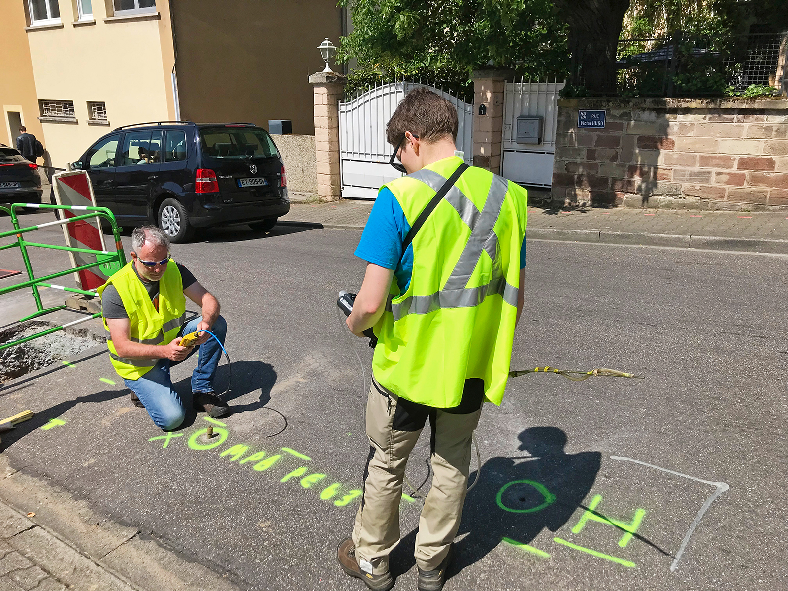
Gas measurements being taken by DPSM-UTAM EST agents. © BRGM
Since 2008, the DPSM-UTAM CENTRE-OUEST has been carrying out video-laser surveillance of a section of the "Z20a" gallery located under a building at a depth of just five metres, in the commune of May-sur-Orne (14). Given that it was close to the surface, the area had to be made safe. The chosen solution was to completely fill in the identified voids, in two phases, following the discovery of additional voids. This operation eliminated the risk of sink-holes (collapse of the ground on the surface) and reduced the level of risk from "high" to "low". But it also eliminated the need for an annual video-laser inspection of two boreholes.
Directional drilling with a 28° incline and a depth of 8.8 m, to search for voids under the building. © BRGM
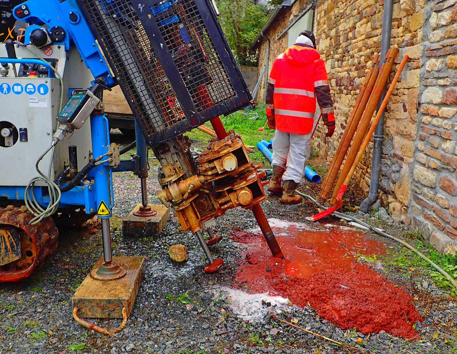
The Fontsante fluorite mine in Tanneron (Var département), which operated from 1963 to 1986, produced 400,000 to 800,000 tonnes of tailings rich in fluorine and trace metals, including arsenic and aluminium, which are stored at the Lenté and Saint-Barthélemy mine dumps, 2 km upstream of the Saint-Cassien reservoir, which supplies drinking water to Cannes. Both dumps are monitored by the DPSM-UTAM SUD as part of its post-mining mission. Erosion of the covers of the dumped materials, a topography favourable to infiltration, as well as the occurrence of resurgences, with precipitation of iron oxyhydroxides on the periphery of the dumps and peaks in the concentration of arsenic and fluorine in the water reaching the Saint-Cassien reservoir, led the DPSM to recommend to government departments that these two deposits be restored by partially remodelling their covers and by consolidating their hydraulic networks.
The work was carried out from October 2022 to April 2023, with the support of a project management team and ecological site-supervision. Clearing the land, followed by earthworks at the Lenté dump, involved stripping topsoil, stripping an asphalt model-aircraft runway, creating a storage cell for site waste, filling in topographical troughs and reprofiling the cover. This was followed by the rehabilitation and creation of hydraulic networks, the reseeding of areas exposed by the works, and finally the reinforcement of the peripheral anti-intrusion system around the two dumps (fences, access barriers, etc.).
Overall view of the Lenté mine dump under construction. © BRGM

