Image
Légende
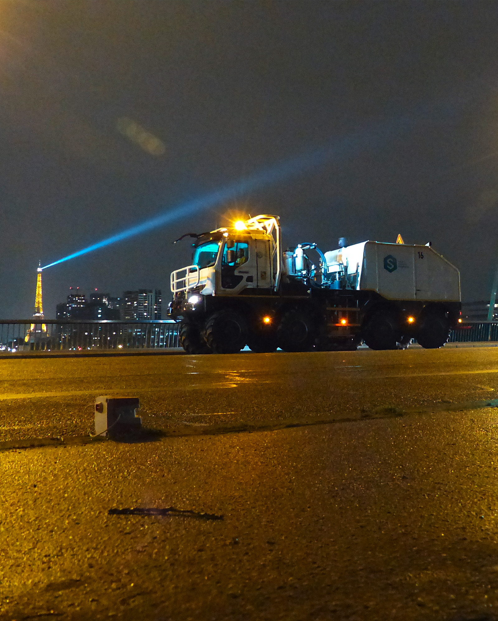
A Geoscan survey was conducted in the Paris region in 2024 in order to obtain seismic profiles of the subsurface using the seismic reflection method. © S3-Robert Famy
 French geological survey
Subsurface energy and decarbonisation
A Geoscan survey was conducted in the Paris region in 2024 in order to obtain seismic profiles of the subsurface using the seismic reflection method. © S3-Robert Famy
A local, continuously available and renewable resource with low greenhouse gas emissions, deep geothermal energy could be a key driver in decarbonising our energy systems and reducing our dependence on fossil fuels. This energy source, harnessed from the subsurface, remains underdeveloped in France. At present, most geothermal sites in operation in France are located in the Paris region and Nouvelle-Aquitaine, even though other regions could hold promising resources.
However, characterising this potential requires a detailed understanding of the subsurface, in particular the geometry and the geological and hydrogeological properties of the geothermal reservoirs. Against this backdrop, BRGM was tasked by the French General Directorate for Energy and Climate with conducting a national inventory of deep geothermal resources. The objective is to better assess the potential of this renewable energy source in France, in order to promote its development.
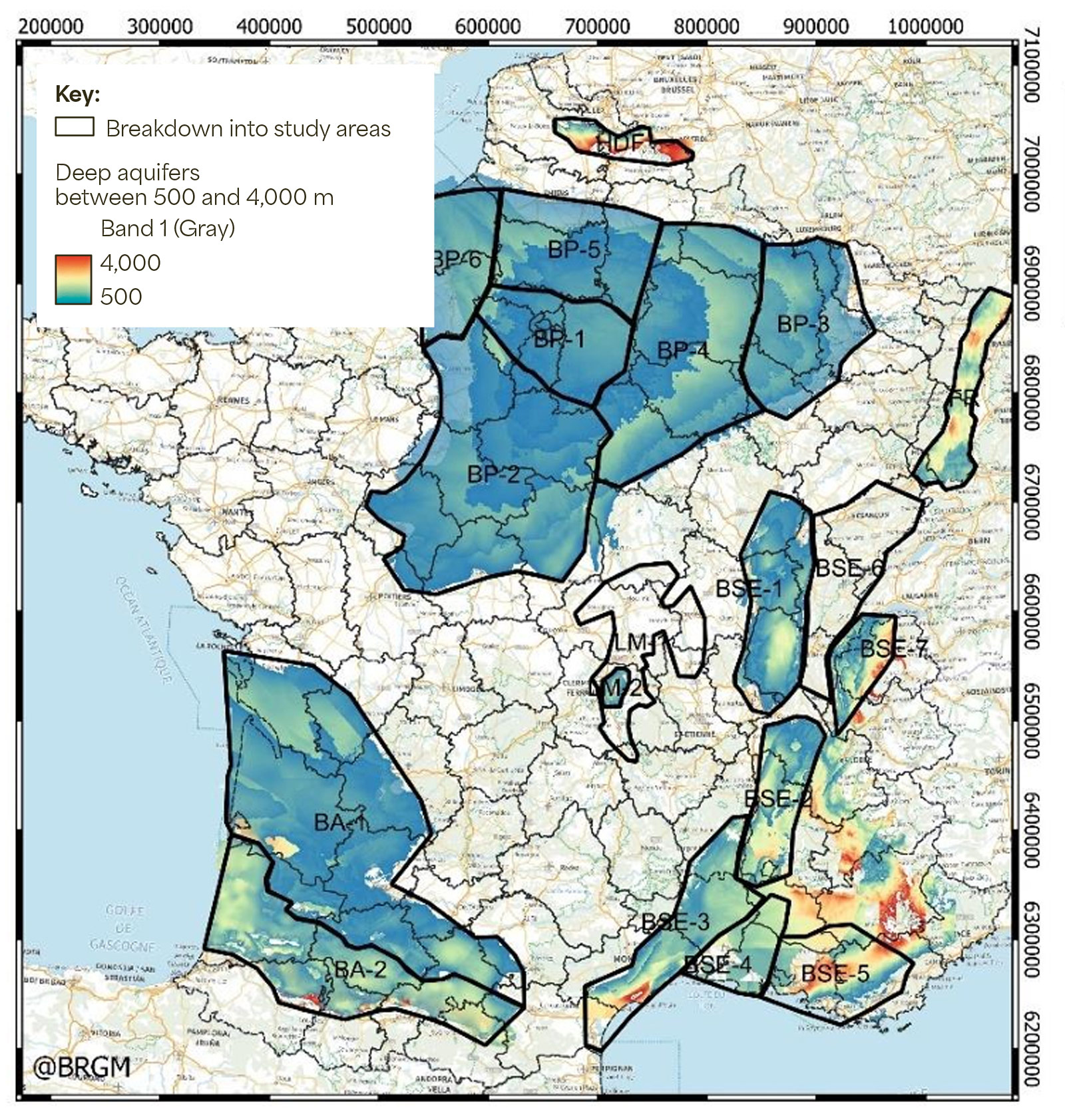
The sedimentary basins of mainland France were divided into study areas for the purposes of the national geothermal inventory. © BRGM
A project with the name of Geoscan Hexagone was launched in 2023. It involves gathering, summarising, reprocessing and exploiting – on the basis of new analyses – all the data available on the various sedimentary basins. As Virgina Hamm explains: “The target area lies at a depth of between 500 and 3,000 metres, so the data we need is obtained mainly from oil exploration or previous deep geothermal projects. This means it involves boreholes or seismic surveys. Depending on the quality of these data, reprocessing makes it possible to extract new information about the structure of the reservoir and its petrophysical characteristics, such as lithology and porosity.”
The first phase of the inventory focused on Loiret (Centre-Val de Loire region), a department known for its geothermal potential, and which has extensive seismic coverage. Also, BRGM signed a scientific agreement with the department in 2024 to strengthen research into the management of its subsurface. This made Loiret the ideal candidate as a pilot area for the roll-out of the inventory methodology and the development of proof of concept.
In 2025, the initiative was extended to the whole of the Centre-Val de Loire region and the former Picardy region. “Around 6,000 kilometres of seismic profiles and 160 boreholes have already been reprocessed and reanalysed,” explains Virginie Hamm. This extensive work has made it possible to characterise the deep geothermal reservoirs in these regions. 3D geological models and maps were produced for each reservoir, providing more precise information on their depth, thickness, temperature and geological suitability – i.e., the probability of finding a facies with reservoir properties.
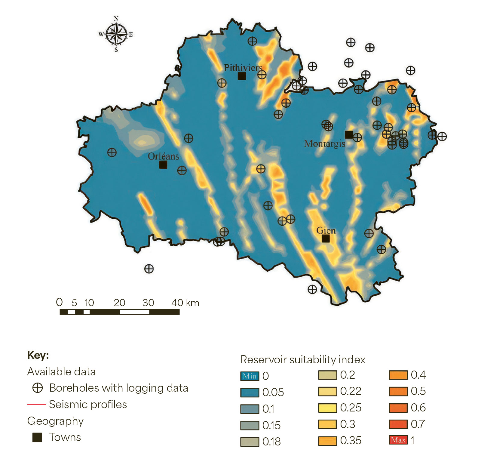
The study into the potential of deep geothermal energy in the Loiret provided the basis for the production of departmental maps indicating the suitability of the Oxfordian (in this case, mid‑Oxfordian), Dogger and Triassic reservoirs. © BRGM
These studies make it possible to identify areas of interest for geothermal exploration, and even sectors where further data acquisition is warranted. “Thanks to these results,” continues Virginie Hamm, “we can target specific sites for the roll-out of the next seismic surveys, as was the case of the Geoscan survey carried out in 2024 in the Paris region.”
The models and maps produced as part of the national inventory are made available on an ongoing basis through the geothermies.fr website, jointly managed by BRGM and Ademe. They represent a valuable resource for players in this sector and also for stakeholders – including industry, local government and the agricultural sector – who are able to develop new geothermal projects based on this reliable scientific information. The inventory is now continuing in other areas with promising potential. In 2026, a similar project began in the eastern part of the Paris Basin, in the Grand Est region (Champagne-Ardenne and Lorraine).