


Image
Légende
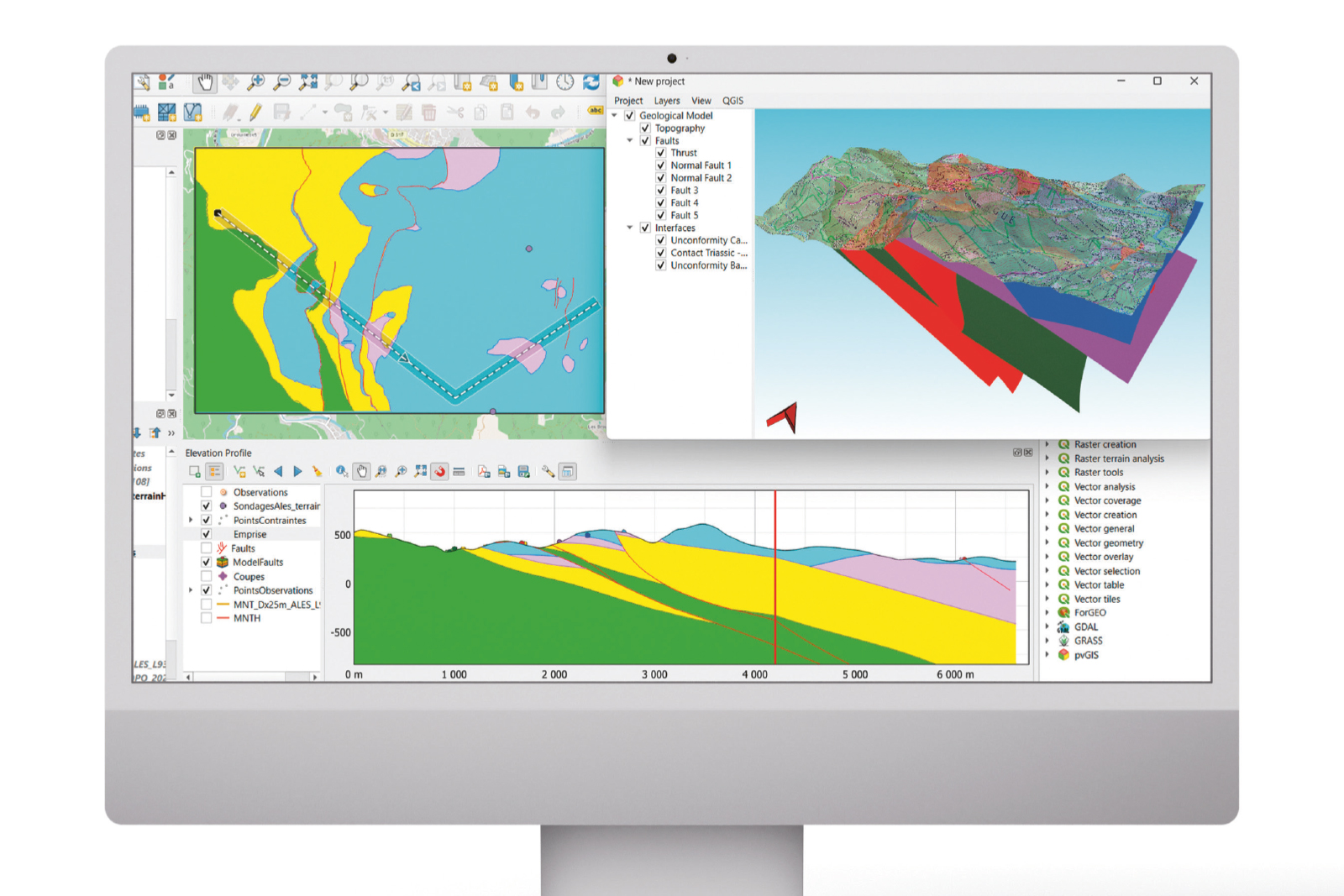
Creation of a 3D model of the Rochessadoule area (Gard) using ForGEO. © brgm
 French geological survey
Geology and subsurface modelling
As part of its optimisation and open science approach, BRGM has redesigned the core functionalities of its tools for producing 3D geological models within a new modular and scalable architecture. Grouped under the name ForGEO, these functionalities have been integrated into the open-source QGIS GIS software in the form of extensions. Using this toolkit, users can build and evaluate 3D geological models while meeting a range of cross-cutting requirements: 3D visualisation, geo-referencing, etc. These developments are available as open source on the gitlab.com platform.
Creation of a 3D model of the Rochessadoule area (Gard) using ForGEO. © brgm
Led by BRGM, the French geological reference platform (RGF) aims to provide digital 3D geological information that is uniform and consistent across the whole of the country. The RGF 2025 conference, held on 24 and 25 March in Orléans, focused on the Paris Basin and the Alps and their surrounding basins. This conference was an opportunity for the parties involved to present the progress they had made. An interdisciplinary study carried out under the Paris Basin project has put forward a new model to explain the simultaneous formation of dolomite and fibrous clays during the Middle Eocene. This work led to the publication of a paper in the scientific journal Sedimentology.
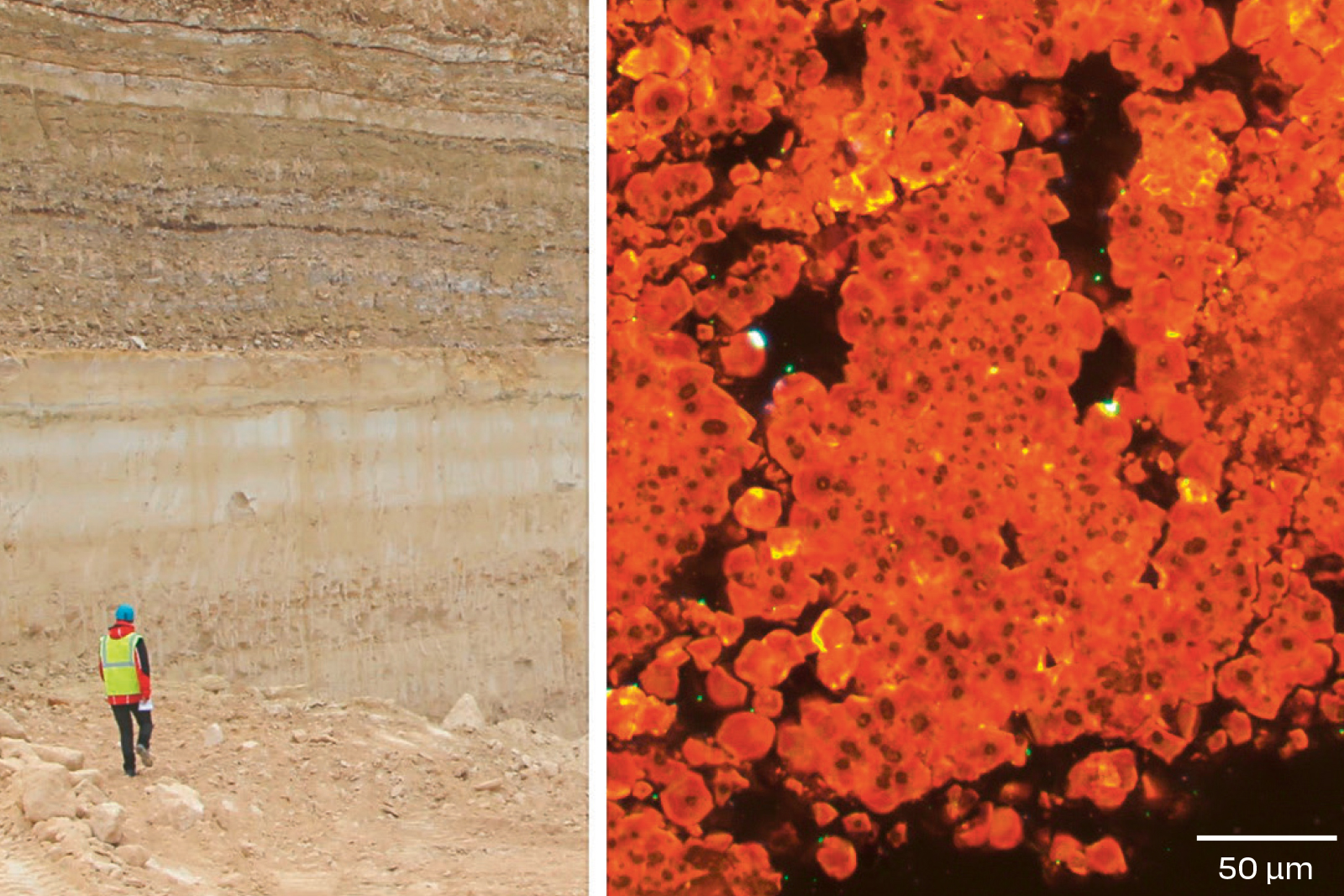
Left: Lutetian strata in a quarry at Saint-Maximin (Oise), with the top of the Coarse Limestone at the bottom and the Marnes et Caillasses (marl and hard limestone rubble) facies at the top. Right: small dolomite crystals with dark centres, newly formed in the Marnes et Caillasses, probably as a result of microbial activity during the late Lutetian period. © Julien Talon
BRGM is developing a research and service infrastructure based on Earth observation data from space, for use in a range of areas: natural hazards, water resources and mineral resources. This project is governed by a contract setting out objectives, resources and performance targets, which saw significant progress in 2025. Satellite data from CNES and the European Copernicus programme (Sentinel) were used to map floods, including those caused by rising groundwater levels, to expand the inventory of landslides and to detect and characterise wetlands and river flow rates. A 3D model of the surface of volcanic clouds was also created and a study was carried out on coastal subsidence in the context of climate change.
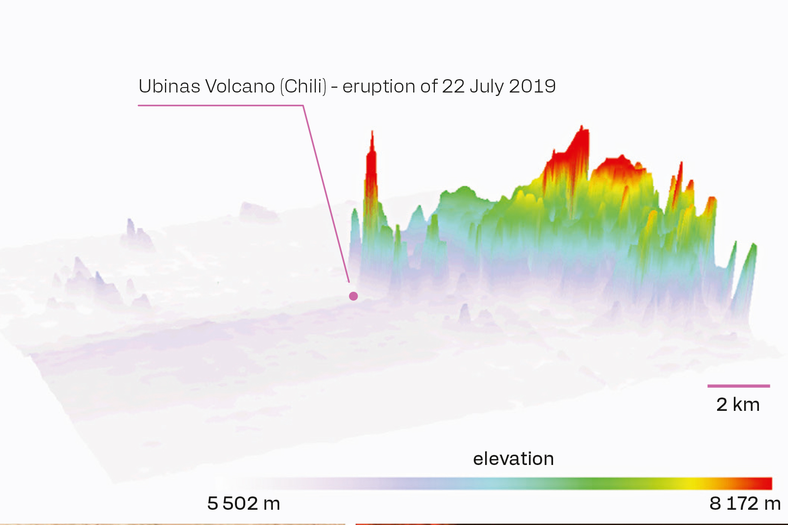
3D visualisation of the volcanic plume elevation model produced by the 2019 eruption of Ubinas (Chile), created using images processed from data acquired by the CNES Pléiades satellite. © brgm
The Massif Central project under the national research programme (PEPR) entitled “The Subsurface: A Common Good”, jointly coordinated by BRGM and the CNRS, applies a multidisciplinary approach to investigate the conditions under which this region could contribute to ongoing transitions. The research focuses primarily on critical metals and the potential for a mining revival, as well as deep geothermal energy. In this context, a new study of the Limagne of Allier shows that it features a structural network consisting mainly of strike-slip faults. These findings call for a reassessment of this sedimentary basin and open up new avenues for understanding and exploring the region’s geothermal potential.
Drawing on its numerous geological models developed since the 1980s, BRGM has started work on producing an initial geometric model of France’s sedimentary basins, which cover more than 70% of mainland France. The principle behind METROSED 3D is to combine certain modelled areas to represent the geometry of the main Mesozoic and Caenozoic stratigraphic sections in sedimentary basins. The first stage, completed in 2025, involved collecting and archiving data on nearly 200 historical models, identifying their footprints and extracting the calculated surface areas. Supported by the Subsurface national research programme (PEPR) under the Digital Earth project, this initiative will contribute to the development of the national geoscience reference platform (see this pages).
Launched in 2025, the EQUIP-G project (Horizon Europe), with 19 partners from 11 countries, aims to promote the adoption of quantum gravimetry in Europe. It involves deploying a network of quantum gravimeters and establishing a pool of shared equipment, managed by an organisation that also facilitates the sharing of data, results and expertise. BRGM and the Orléans Institute of Earth Sciences (ISTO) have the task of using hydrogravimetry to study variations in water reserves in the unsaturated zone of the Beauce limestone aquifer. For this purpose, the project is based at the O-ZNS platform in the Loiret, where quantum gravimeters will be installed both on the surface and at depth.
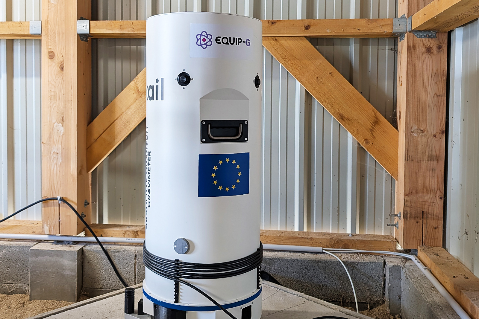
The AQG quantum gravimeter undergoing measurement tests at the site of the Earth Sciences Institute of Orléans (ISTO) Observatory for Transfers in the Unsaturated Zone (O-ZNS) in the Loiret, under the EQUIP-G project. © brgm
In collaboration with the National Radioactive Waste Management Agency (ANDRA), BRGM is running a project at its Meuse/Haute-Marne centre to measure and analyse variations in the water content of a Callovo-Oxfordian claystone spoil tip during rainfall events. This research is based on the use of non-destructive geophysical methods, primarily electrical resistivity tomography (ERT), to visualise the infiltration of rainwater over several days by measuring the electrical resistivity of the catchment. The project has entered the testing phase.

