


Image
Légende
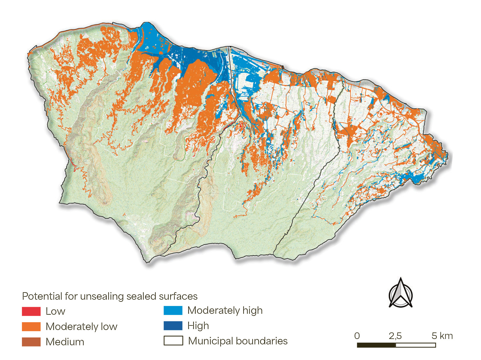
2025 map of surfaces within the Inter-municipal Community of Northern Réunion (CINOR) that could potentially be unsealed. © brgm
 French geological survey
Risks linked to the ground and subsurface
How can we improve rainwater infiltration, restore the ecological functions of the soil and protect groundwater resources? To provide data and input for an informed debate on these issues, the Inter-municipal Community of Northern Réunion (CINOR), which comprises Saint-Denis, Sainte-Marie and Sainte-Suzanne, launched the ZAN CINOR project, within the framework of the national Zero Net Artificialisation (ZAN) plan. To support the local authorities in their "unsealing" initiatives (aimed at reducing impermeable surfaces), BRGM applied the DésiVille method – which it had developed for the Nantes metropolitan area – while adapting it to the context of La Réunion, by using a hybrid multi-criteria GIS approach and, notably, by re-qualifying the weighting applied to the slope of the ground. The results identified significant potential for unsealing, representing 86.61% of the region's impermeable surfaces.
2025 map of surfaces within the Inter-municipal Community of Northern Réunion (CINOR) that could potentially be unsealed. © brgm
In 2025, at the request of the French Government and for the purposes of the 3rd National Climate-Change Adaptation Plan, BRGM updated the map of exposure to clay shrinkage and swelling, which was drawn up in 2019 and became the reference base for regulatory zoning in relation to this phenomenon in 2020 (through the Élan Act). Available online on Géorisques – and due to come into force on 1 July 2026 – this document shows that areas with medium or high levels of exposure to clay shrinkage and swelling now cover 55% of the country (compared with 48% previously).
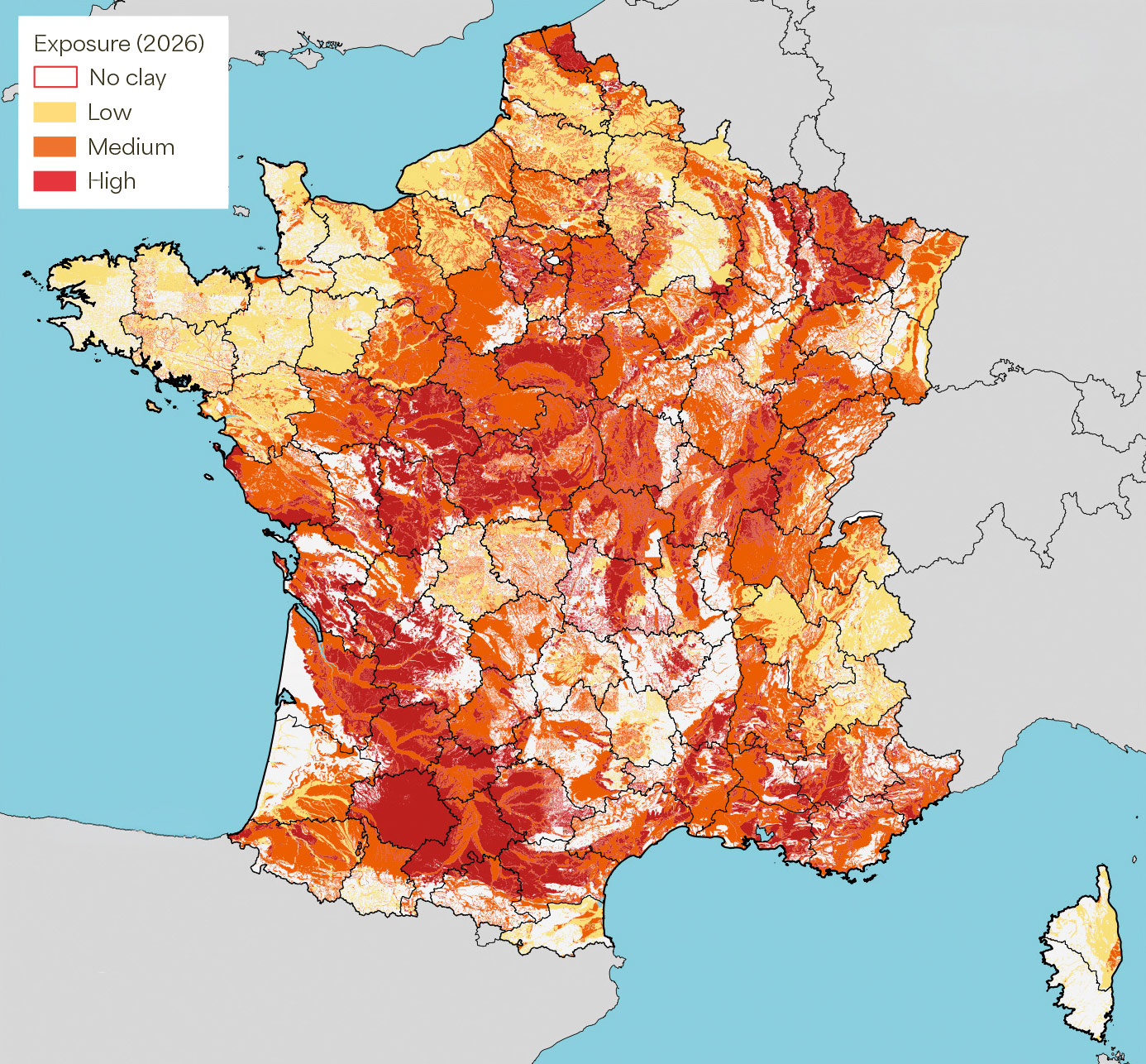
The map of exposure to clay shrinkage and swelling has been updated to include data from recent incidents and claims and to incorporate methodological improvements. © brgm
Coordinated by NORSAR, the Norwegian Seismic Monitoring Network, the European MEDiate project (2022–2025) worked on developing a multi-risk approach to resilience, taking into account the evolution of each risk over time, depending on the levels of exposure and vulnerability. In this context, BRGM developed multi-risk vulnerability models for buildings, incorporating, for example, the interaction between earthquakes and flooding. A pilot area was set up in the Nice metropolitan area (a partner in the project), in order to jointly establish multi-risk scenarios. Several workshops were held locally, including a serious game developed by BRGM based on Storm Alex in 2020, which highlighted the importance of the decision-making process involved in identifying remediation solutions based on different criteria.
Conducted in partnership with the French Development Agency (AFD) and the Republic of Mauritius, the MauRisCot project was completed in 2025. Its objective was to assess coastal hazards and the associated risks in Mauritius and Rodrigues, as well as how these might evolve due to the (expected) effects of climate change. Various studies were carried out on the coasts of the two islands, focusing in particular on coastline retreat, coastal erosion and coastal flooding in cyclone situations. Based on the results, a map was drawn up showing the risks and hazards in each coastal area, along with an assessment of the various adaptation options, particularly through nature-based solutions. These results will help establish action plans for protecting people and property, as well as remediation plans.
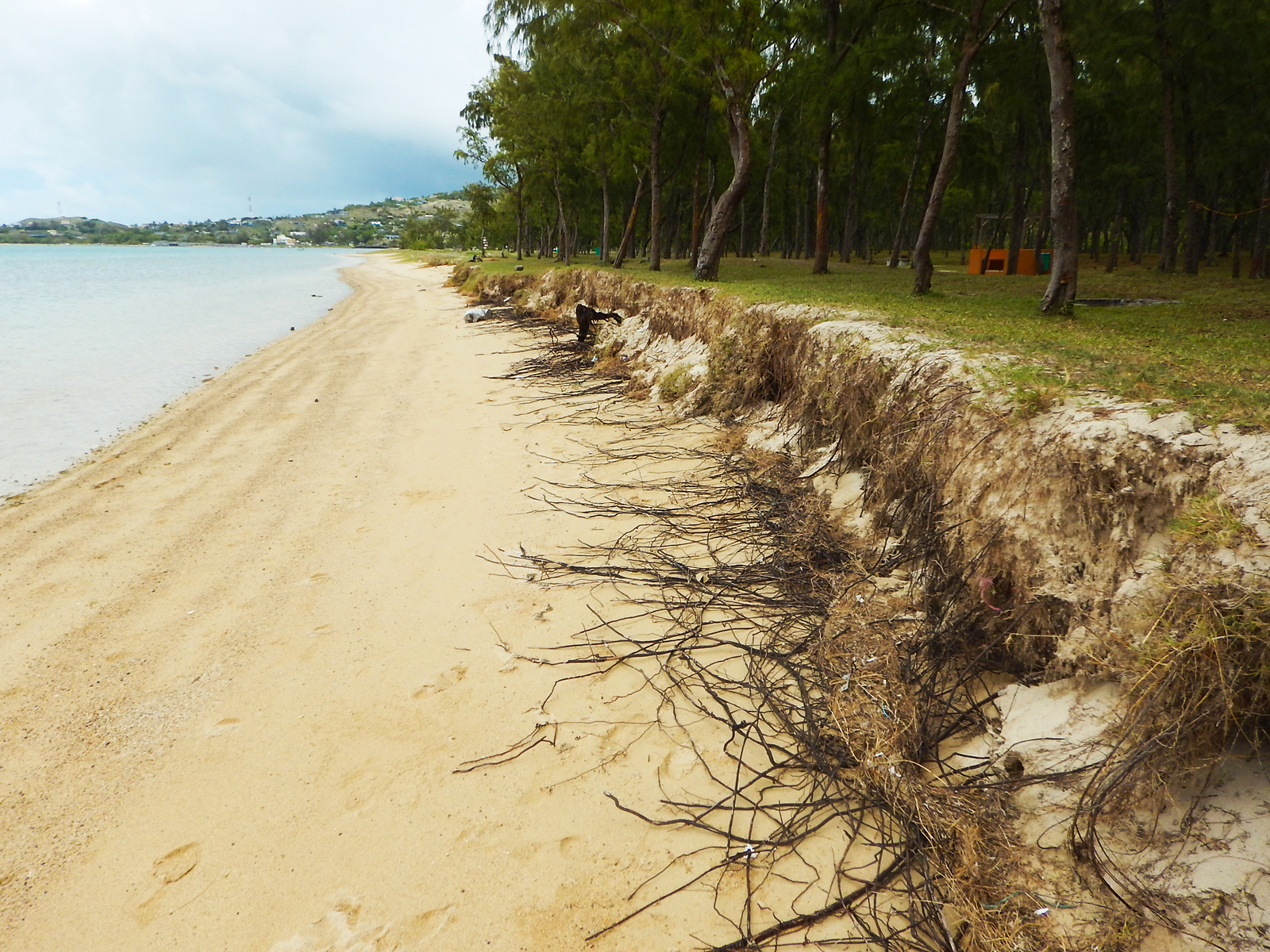
The effects of coastal erosion at Mourouk bay in the south of Rodrigues Island. © brgm
A PhD thesis jointly supervised by BRGM explored an innovative and sustainable approach to monitoring the decontamination of soil polluted with hydrocarbons: it uses spectral induced polarisation (SIP) to monitor the biodegradation of toluene by bacteria in real time. It provides an environmentally friendly and cost-effective alternative to conventional methods for monitoring soil decontamination. Two scientific articles were published: the first demonstrates the ability of SIP monitoring to detect the electrochemical signatures of bioremediation; the second presents a state-of-the-art Bayesian inversion method capable of directly estimating key biogeochemical parameters, along with their uncertainties.
BRGM is committed to addressing the issue of PFAS and is heading up several projects aimed at gaining a better understanding of these highly diverse per- and polyfluoroalkyl substances and their behaviour in the environment, and developing remediation solutions. As a participant in the French inter-ministerial action plan launched in 2024, BRGM has developed a tool for visualising data from operations aimed at monitoring these substances in water across the country. The “Info PFAS” map allows users to locate sampling points and view the results of the associated measurements. In July 2025, when the map went online, more than 2.3 million analyses were already available to everyone. An extremely comprehensive list of frequently asked questions (FAQ) about these so-called “forever” chemicals has also been published on brgm.fr.
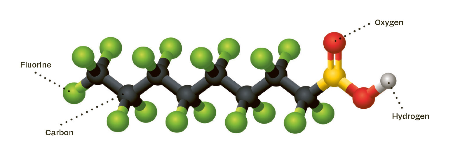
PFAS are characterised by their persistence in the environment, due to their highly stable and resilient carbon-fluorine bonds. © brgm
At the end of July 2025, the backfill at the former "Machine Anglaise" mine shaft subsided beneath the right-hand lane of a slip road between the RN 488 highway and the A72 motorway. During rush hour, up to 2,200 vehicles an hour travel along this key road, which bypasses Saint-Étienne (Loire department) and runs alongside a high-speed fibre-optic network. Since it had been established that the problem was caused by a mine, BRGM carried out urgent work on the shaft-head to enable traffic to resume on the road. The final road stabilisation and safety works were carried out the following autumn and were facilitated by the effective coordination between the various parties involved. Traffic returned to normal before the Christmas holidays.
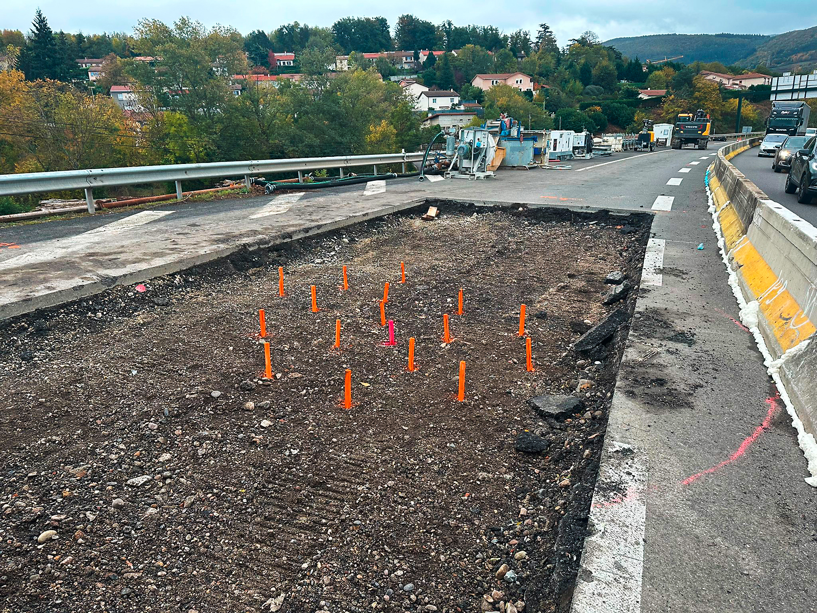
Installation of jet grouting columns in the backfill of the former mine shaft located beneath the Saint-Étienne motorway bypass. © BRGM
In September 2025, BRGM carried out work in Vieux-Vy-sur-Couesnon (Ille-et-Vilaine) to secure a shaft head at a former lead and silver mine. A farm tractor had driven over the closing slab of the shaft head, damaging it and leaving a hole of about 50 centimetres in width, open over a 6-metre-deep chasm. The slab was first dismantled so that the shaft-head could be opened up. A conical plug was then built, consisting of blocks of rock (80–100 cm) grouted together with concrete. Finally, a mound of loose stones was created, covered with earth and seeded so that it would blend into the agricultural landscape.
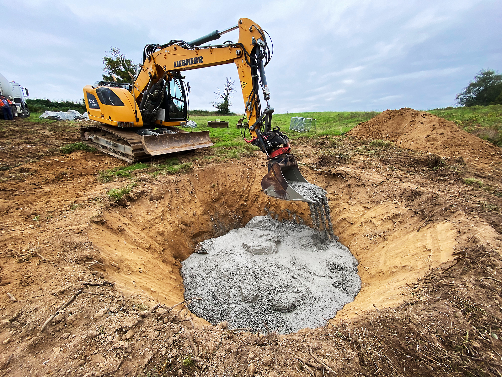
Construction of a conical plug by grouting blocks of rock together with concrete, in order to secure “Shaft 8” at a former mine in Vieux‑Vy‑sur-Couesnon. © brgm
On 11 June 2025, BRGM awarded Saur France a six-year contract to manage the hydraulic safety installations (IHS) in the coal-mining basin of Nord-Pas-de-Calais. This public contract covers the operation and maintenance of the 52 pumping stations that regulate rainwater and run-off that can accumulate in subsidence basins caused by mining, thereby helping to prevent flooding across an urban area of 6,000 hectares.
A test programme aimed at monitoring a former mining site in the Lorraine iron ore basin using a muon telescope was launched in July 2025. The programme will run for several months. Muography makes it possible to identify areas of weakness within an object by analysing variations in density derived from the speed at which muons travel through it. Funded by BRGM Invest, this collaborative project involving BRGM, IRIS Instruments and Muodim will conduct tests in Thil (Meurthe-et-Moselle) in a cavity that is prone to collapses. It should enable the covering terrain to be characterised in order to determine the backfilling work required, as well as to validate this method of non-destructive testing in subsurface environments proposed by Muodim.
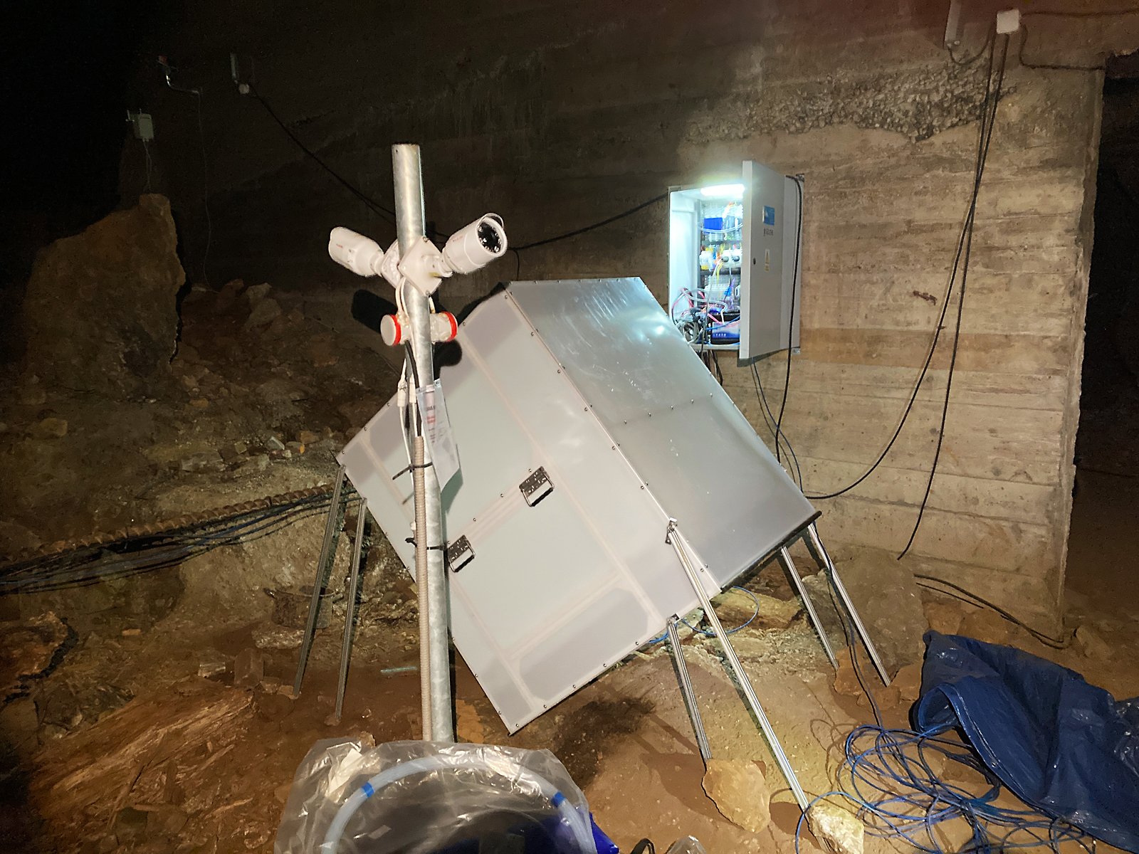
A muon telescope installed in a former iron mine in Thil. © brgm
Mining operations at the former tin mine in Abbaretz (Loire-Atlantique) left behind deposits of processing residues and mine tailings. In response to hydraulic erosion in the lagoon, which had reduced its retention capacity, BRGM conducted works to reduce the transfer of sediments from the lagoon to natural environments further downstream and facilitate maintenance of the site. To start, weirs were built with rocks at the bottom of the ravines to slow down the water flow and trap pollutants. A reinforced track was constructed to enable dredging machinery to access the lagoon more easily. Finally, two steel sheet-pile walls were installed to create three settling basins. Due to certain technical difficulties that required methodological adjustments, the work was not completed until early 2026.
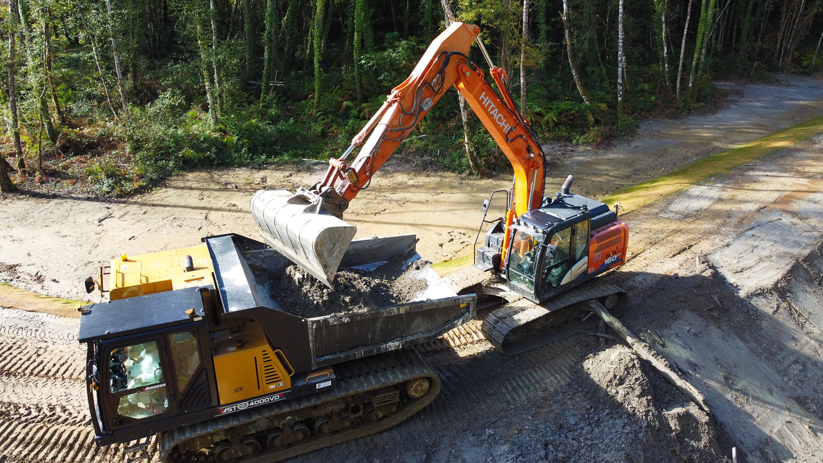
In Abbaretz, a tipper truck being loaded with material extracted from the lagoon during dredging operations aimed at restoring its retention and settling capacities. © brgm
The discovery that air in homes in Moyeuvre-Grande (Moselle) was contaminated with CO2 and radon led BRGM to investigate the possibility of reopening access points to former mining sites. During the field investigations, the team’s progress was halted in one area by high concentrations of CO2 and the presence of water resulting from the flooding of the reservoir. A drone was therefore used to explore a further 250 metres of straight tunnels, above the submerged section. Thanks to this innovative underground solution, BRGM was able to make recommendations about how to improve the ventilation of these former mining sites.

