Image
Légende
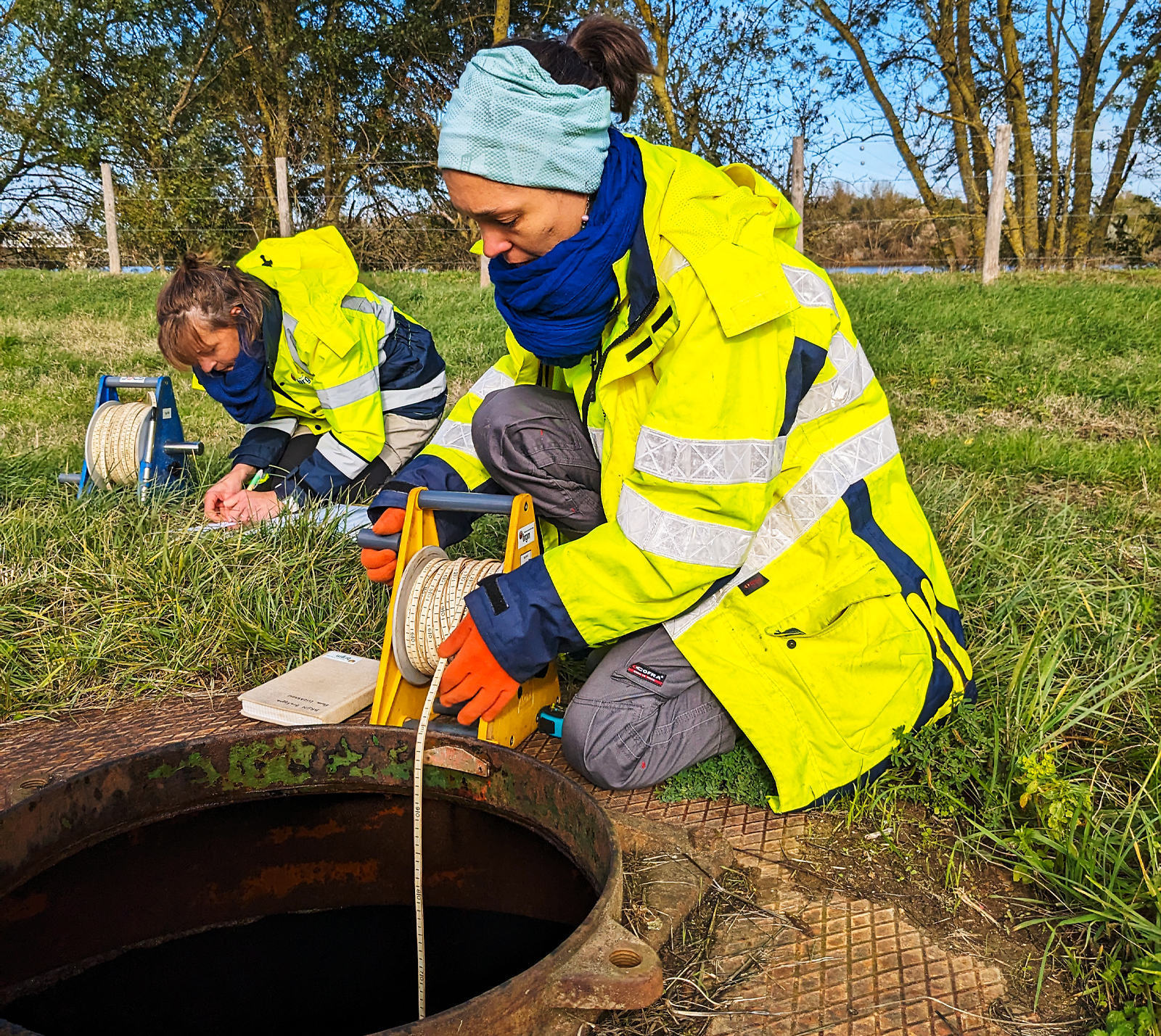
The national piezometric network, which includes MétéEAU Nappes, has 1,600 real-time groundwater level monitoring points, as shown here in the Pays de la Loire region. © brgm
 French geological survey
Groundwater and resource preservation
The national piezometric network, which includes MétéEAU Nappes, has 1,600 real-time groundwater level monitoring points, as shown here in the Pays de la Loire region. © brgm
In the face of increasingly extreme weather events, predicting the behaviour of groundwater bodies has become a major issue for regional water resource management. Nearly two-thirds of the water abstracted for the drinking water supply in France comes from groundwater. The MétéEAU Nappes web platform was developed in this context to provide assistance to all local public water authorities, in particular local authorities, territorial public basin authorities (EPTBs) and drinking water associations. It also serves as an operational tool for government departments and water agencies, supporting strategies to ensure the availability and sustainability of water resources on both local and national levels.
Originally launched online in 2021, MétéEAU Nappes has been completely redesigned to better meet users’ needs and improve its impact on groundwater management. Since June 2025, the website has featured a modernised interface to make it easier to use on mobile devices. Access to information is further facilitated, with the immediate display of the groundwater monitoring bulletins (BSN) made available to the public. Users can browse the platform without having to create an account. As a management tool, MétéEAU Nappes is also becoming an established means of communication and awareness raising among the general public.
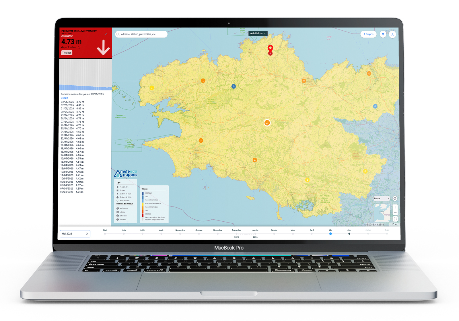
Clicking on a piezometer in MétéEAU Nappes such as the one shown here, located in the commune of La Roche-Jaudy (Côtes-d’Armor), displays the groundwater level in real time and its recent trends. © BRGM
Starting from the current situation, users can easily navigate back and forth through time to view changes in groundwater levels over the last few months, or access future projections based on modelling carried out by BRGM. Dynamic maps and charts are updated continuously. The data used comes from the national piezometric network, which is managed by BRGM in partnership with the State Directorate for Water and Biodiversity; this network comprises 1,700 monitoring points, 1,600 of which monitor aquifer levels in real time. MétéEAU Nappes provides an up-to-date overview of the groundwater situation across the whole of France, while also serving as an archive of past conditions.
“This development is in response to the situation arising from the severe drought of 2022, which caused difficulties for many groundwater resource management stakeholders,” explains Anne-Valérie Hau-Barras. “This episode highlighted the importance of sharing the information collected in real time in the field more quickly and efficiently and of sharing seasonal forecasts on changes in groundwater levels. Brittany was particularly hard hit during this episode,” adds Bruno Mougin. “Following this event, the Regional Authority decided to commit to rolling out MétéEAU Nappes throughout the region. In January 2025, it signed a partnership agreement with BRGM to extend the monitoring of local aquifers in the tool by increasing the number of forecast points from 1 to 25."
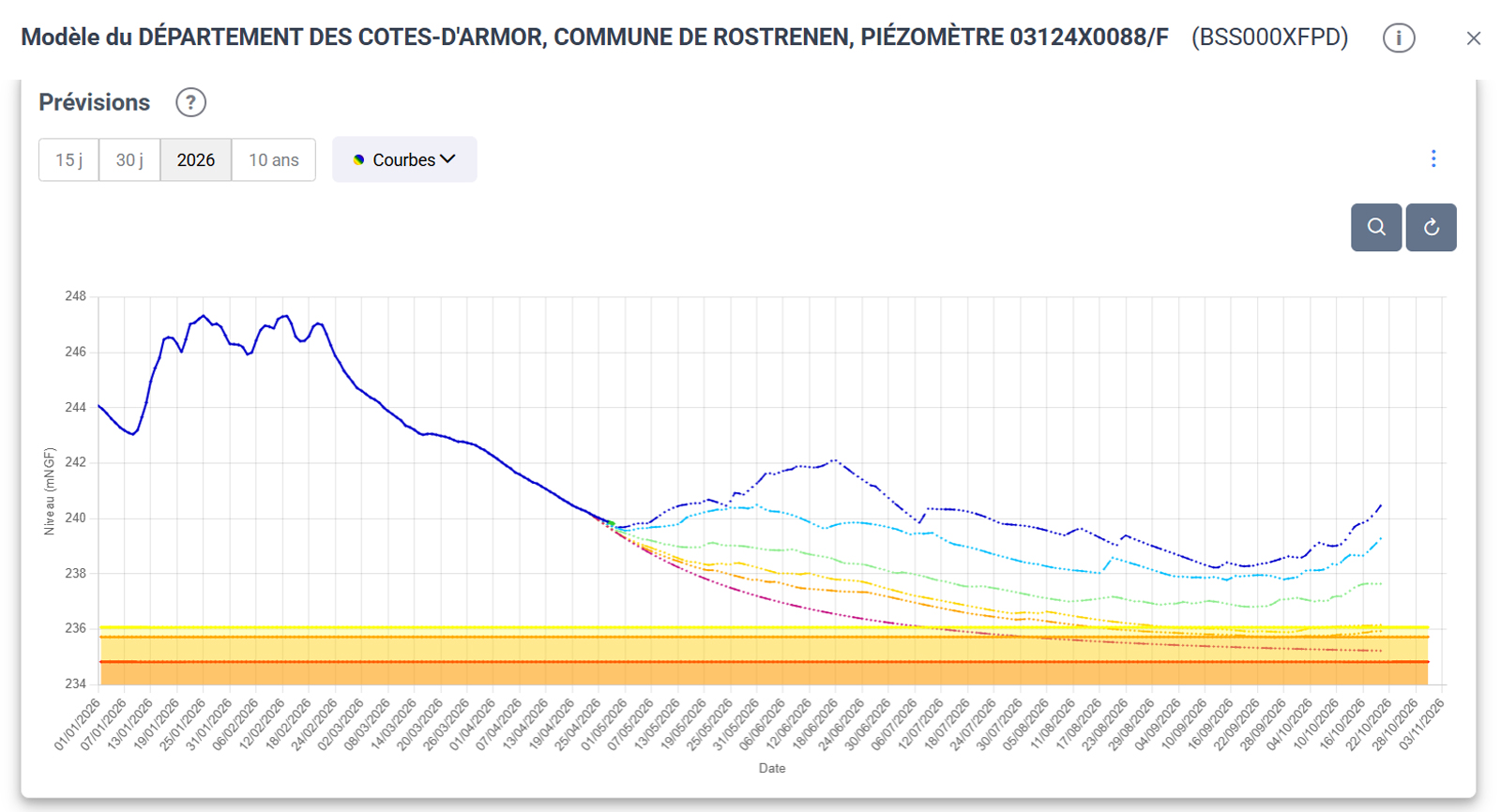
Depending on their account settings in MétéEAU Nappes, some users can view up to six months of forecasts for modelled locations, such as the one shown here for Rostrenen (Côtes-d’Armor). © BRGM
By increasing the number of monitoring points, changes in groundwater levels can be monitored in more detail and more reliable forecasts can be made. Since June 2025, MétéEAU Nappes has also improved its performance and forecasting capabilities by integrating a new open-source calculation code called Rameau, which resulted from BRGM research projects. “We can now predict how groundwater levels will change over the next six months by providing several forecasts based on different climate scenarios,” explains Anne-Valérie Hau-Barras. These forecasts warn decision makers about potential droughts and help them take preventive measure.
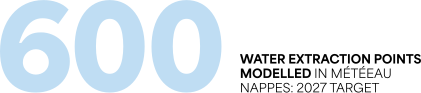
Building on the development of partnerships with local authorities including in the overseas territories, which are also facing water shortages, the expansion of the Rameau code and the increasing integration of artificial intelligence, BRGM has set itself the ambitious target of modelling 600 water extraction points in MétéEAU Nappes by the end of 2027. This would be a first in Europe in terms of national coverage.
Find out more about MétéEAU Nappes